
Overview
The Sierra Nevada are a small and lovely range, less visited than the Pyrenees or Alps, but they offer wildlife, solitude, high peaks and clean air. This week-long trek is guided and includes both camping out and staying in mountain refuges. You will need carry your own rucksack, and our staff will provide all the meals. The route is quite rugged, not always well mapped or signposted, but not technical.
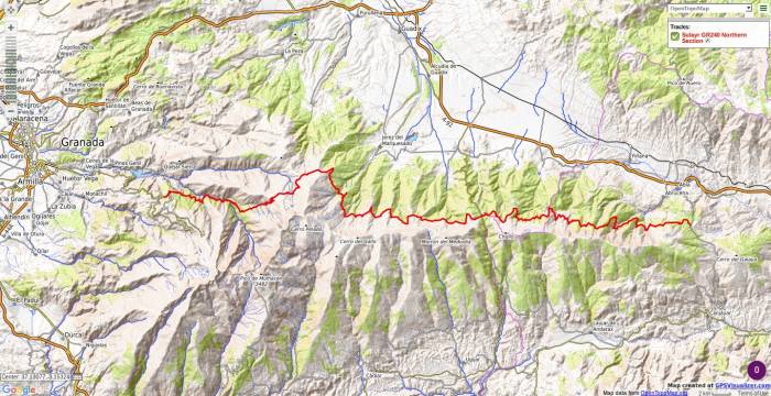
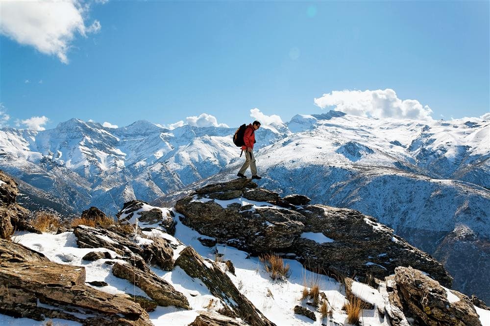
The route across the Sierra Nevada is often referred to as Los Tres Miles or the Ruta Integral Sierra Nevada. There are various options but generally it climbs up onto the spine of the Sierra Nevada range and passes along a string of peaks without really dropping down more than a few hundred metres. You also ascend Mulhacen which is 3478m high and the highest point in mainland Spain and the second highest European peak outside the Caucasus and Alps.
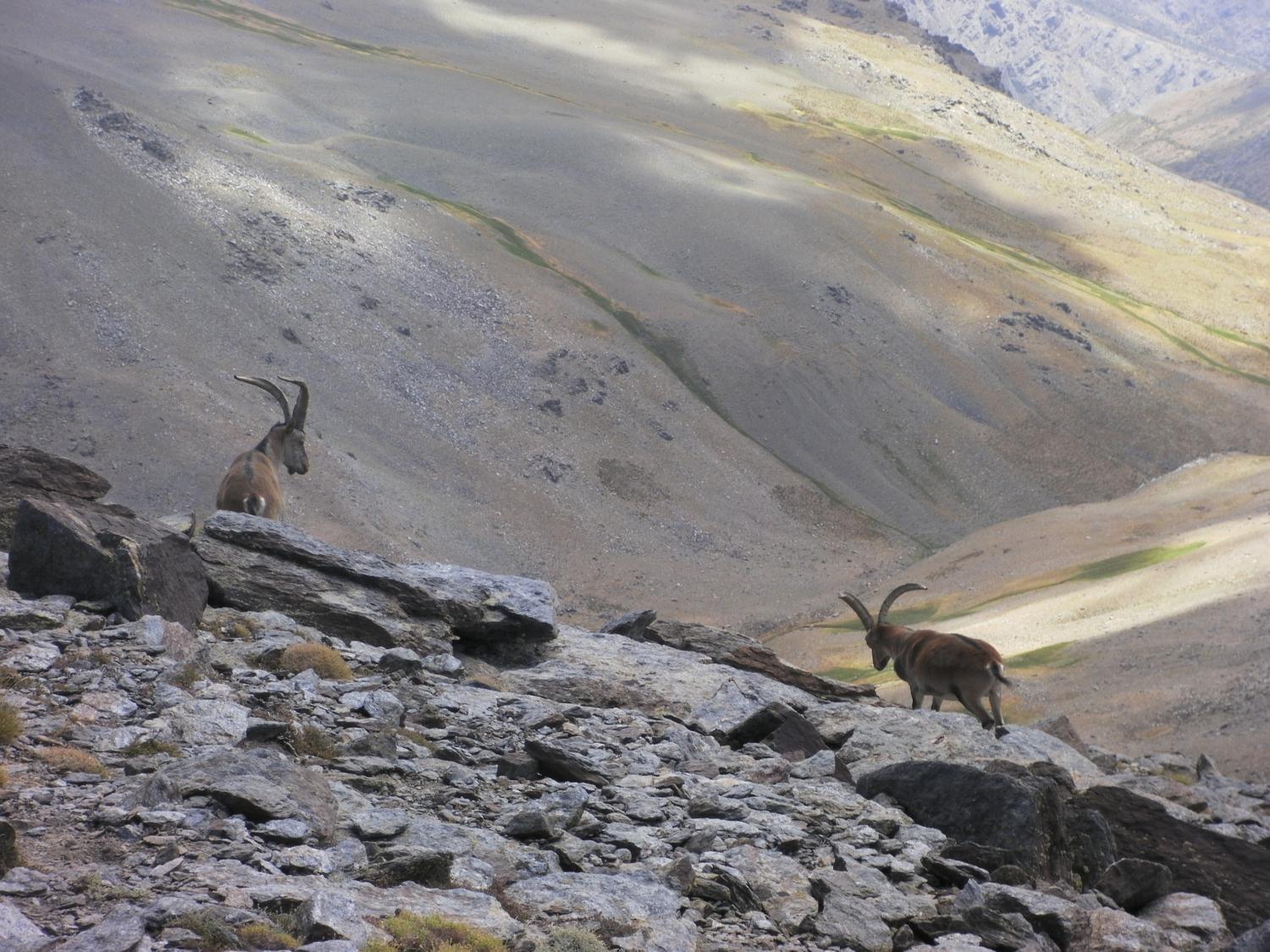
The trek is not difficult and not too steep either, but in the summer the heat can be intense. There is a lot of bird life and local wildlife such as the Iberian ibex, and the views across to Granada to the north and the Mediterranean to the south are inspiring. Trekkers carry their own rucksacks and sleep under the stars, and the staff prepare the meals. There are some refuges along the way which we can use, but the aim is to travel light and enjoy the hiking in a self-sufficient way.
After the trek there will be time to relax and see a bit of how the locals live in the Alpujarra. There is a wealth of local Andalucia custom and culture which is still alive and thriving. You can visit local organic olive farms and historic buildings. Alternatively visit the city of Granada and enjoy the famous Alhambra, or go to the coast and enjoy some time on the beach.
When to go - weather and camping
August and September are generally the clearest months for trips to the higher parts of the Sierra Nevada. June and July can also be good in terms of weather though some years there may still be quite a lot of snow left on higher ground which may force changes to the route and peaks achieved.
Generally the weather conditions in the Sierra Nevada in summer are very stable with clear blue skies and very little rain. The lower sections near the start and end of the walk can be quite hot and dry but as we gain altitude it gets fresher and a cooling breeze can be very welcome. If there is some cloud cover and a wind is blowing then it can feel quite cold on the tops and you will need a few warm layers, hat and gloves, especially after the sun has gone down in the evening and when we are getting up in the morning.
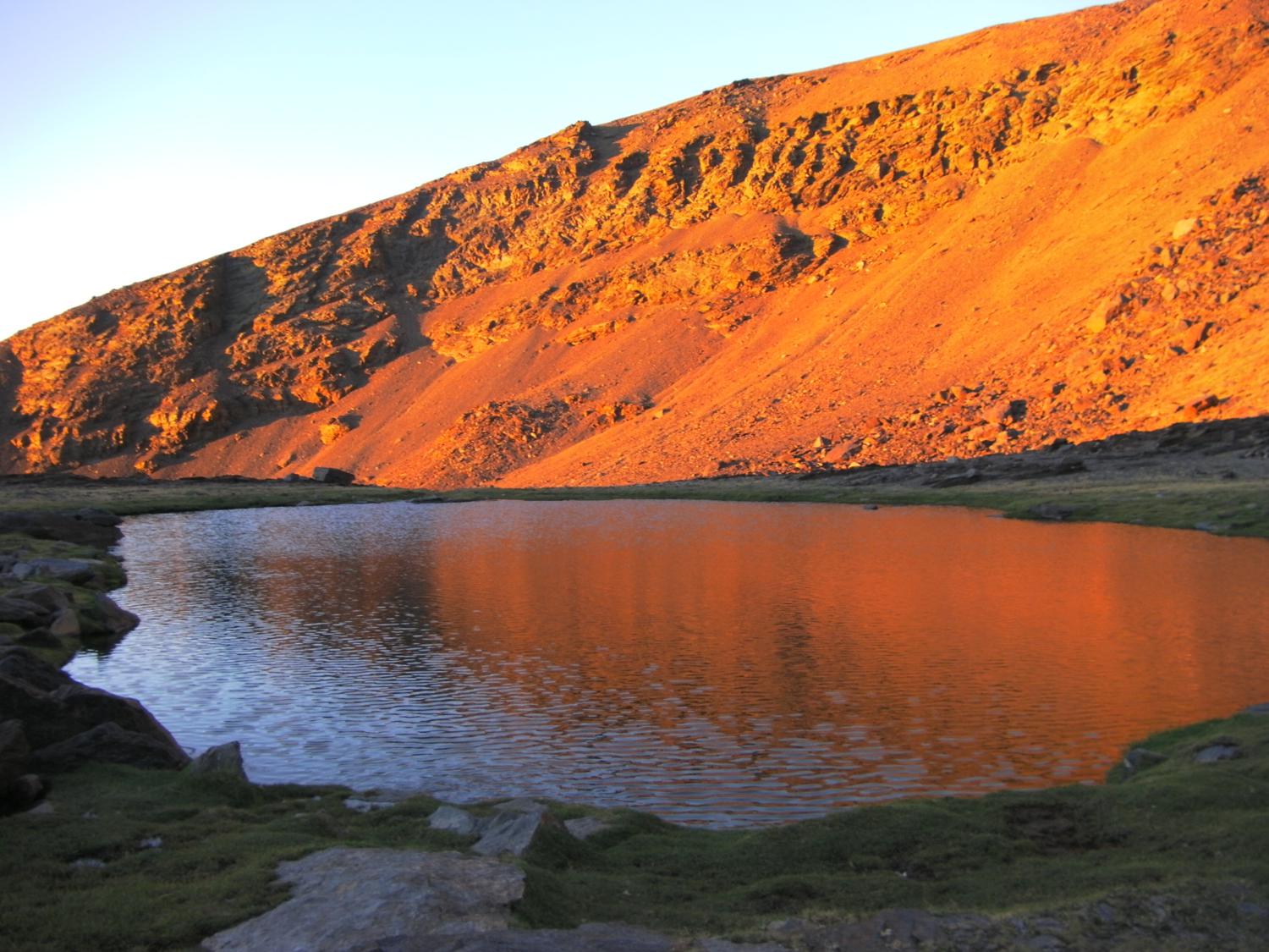
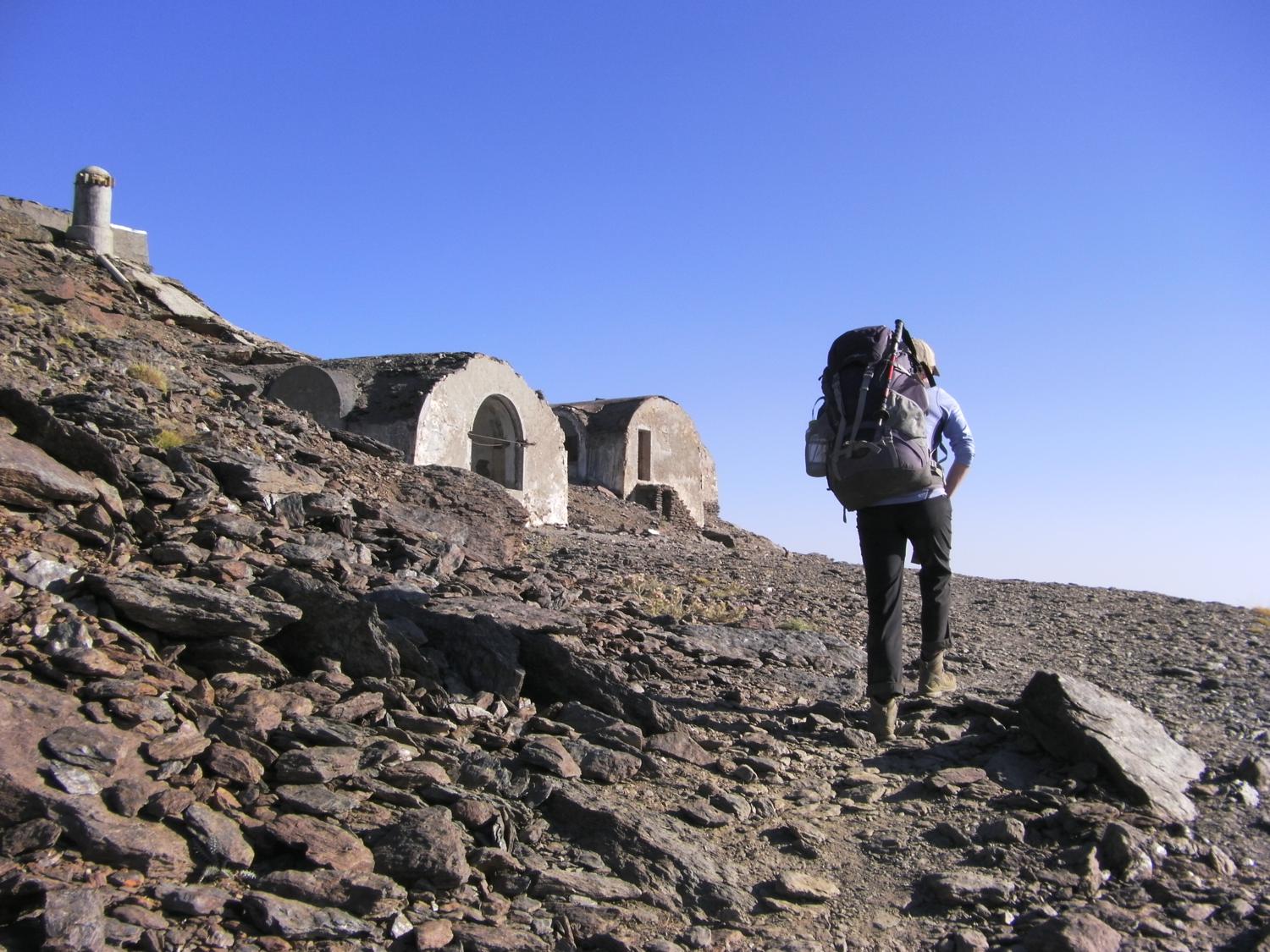
On the trek we will be camping out in tents or staying in some of the mountain refuges. It is quite common for people to bivouac on this trek and therefore to either sleep out under the stars. The programme is fairly flexible but camping locations are largely dictated by access to running water. The local guides know the area very well and will have options in mind for places to stay the night.
We will of course observe best practice in terms of "Leave No Trace" camping throughout. We ask all our clients to help us with this by checking for any rubbish and packing it out.
We will be re-supplied with food and water by mules where required. Our local guide will co-ordinate this at the time and it will mean that we do not have to carry fuel, food and water for the full 5 days throughout.
Summary of itinerary
- Fly into Malaga and travel by road to Lanjaron to spend the night.
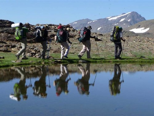
- 5 days walking the length of the Sierra Nevada on a series of peaks forming a high ridge, wild camping at high lagunas.
- A full day in and around the beautiful hillside village of Mairena staying in Las Chimineas.
- A final part day in Mairena before transport back to Malaga airport and flight home.
We recommend for a map of the area, Parque National de Sierra Nevada La Alpujarra (Editorial Penibetica) 1:40000 available through Stanfords in London.
We can easily arrange for you to spend longer in the hotel, subject to availability, or to transfer to other places such as Grenada or Ameria or Malaga.
Fitness, packing and terrain
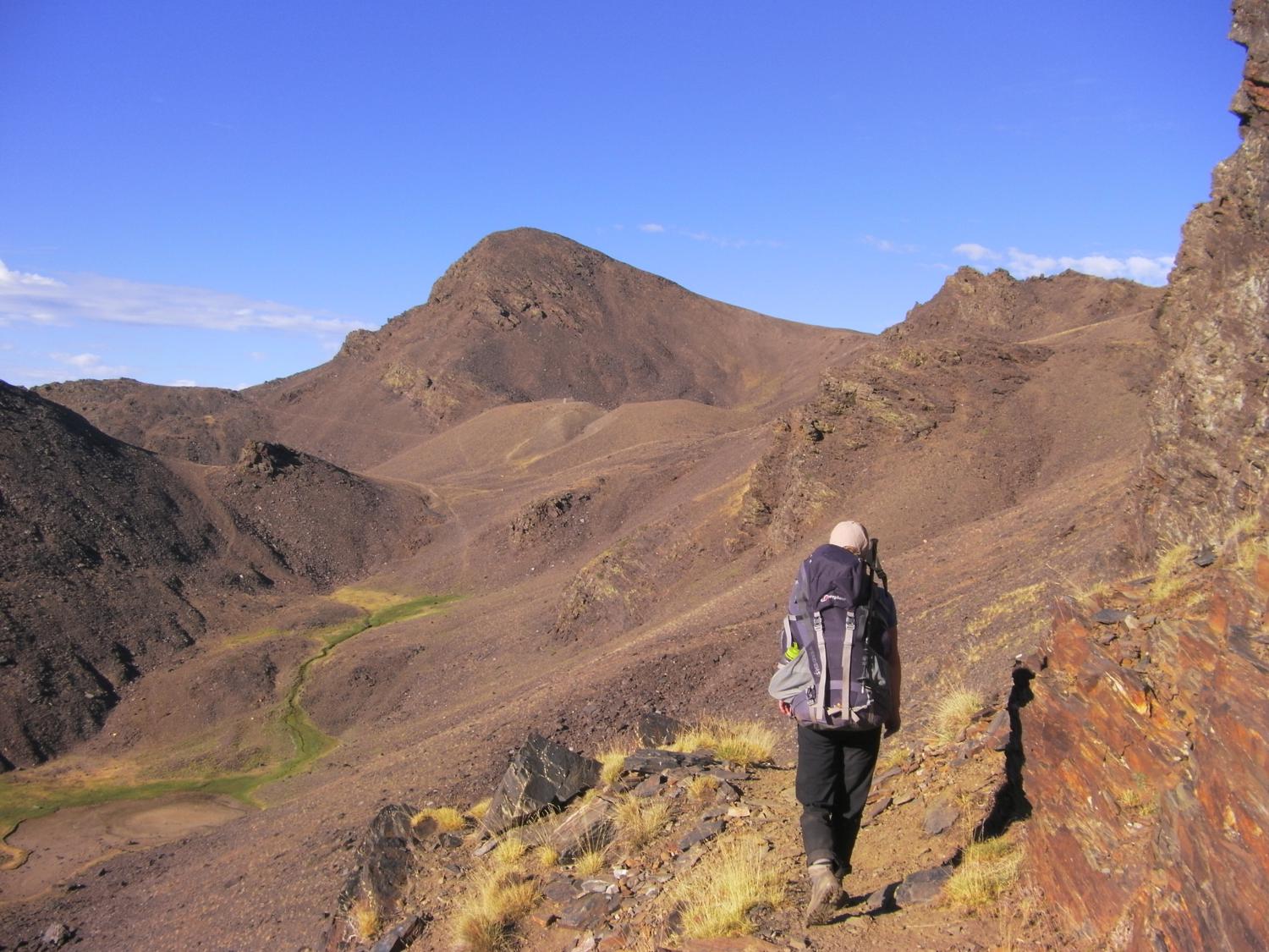
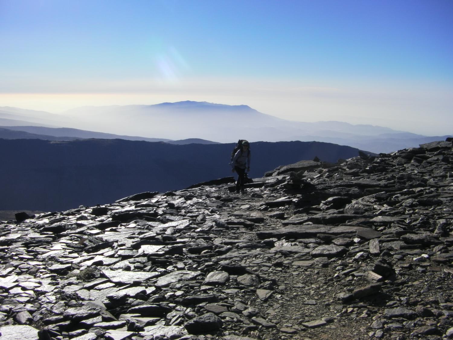
You do need to be fairly fit for this trip, the trek involves sustained walking with a backpack. You will enjoy the trip all the more if you are in good physical shape. The ascents on this trip are walks and there is no rock climbing or scrambling. In general you will be traversing a broad open ridge line which rises and falls to local peaks and cols. Some of the peaks require a steeper climb and the ground can vary from a dusty path to stepping over large boulders or among slatey rocks. Our camps will be down off the exposed ridge and dictated largely by access to running water which is safe to drink straight from the streams.
You will need a 45 litre daypack with waterproofs, spare warm layers, some snacks and water and a few other items. The mules will carry other equipment and meet us at the camps. Or in a small group travelling light we can carry all our belongings in our own rucksack and have the travel clothes transferred to the hotel in Mairena.
Your clothing needs to be adaptable, shorts and tops plus trousers and light fleeces with a jacket and waterproofs.The days can be hot and the evenings chilly. Sun hat and sun protection is important, plus a warm hat and gloves for the nights and early mornings. Boots need to be light weight but supportive, preferably with ankle support. A 3 season sleeping bag should be adequate for camping out, and a good quality sleeping mat like Thermarest or the Exped range.
Clothing should keep you warm, dry, protected from the sun, and able to move easily on the mountains and be comfortable in the evenings and night.
Lightweight clothes and boots for summer treks
- Hiking boots
- Waterproof and windproof jacket
- Down or fleece jacket or gilet
- Hiking trousers and tops (some long sleeved)
- Base layer
- Socks and underwear
- Fleece gloves
- Warm hat and sun hat
- 3 season sleeping bag
- Karrimat or Thermarest
- 50 litre or larger rucksack
- Trekking poles
- Mug and plate and cutlery
- Torch or headlamp
- Sunglasses, suncream and lipcream
- Two water bottles and/or platypus
- Digital camera and power pack
- Personal first aid/medical kit
- Toiletries and toilet paper (recyclable)
- Rubbish bag
Provided from Adventure Alternative:
- Lightweight tent or bivvy bag
- Gas stoves and cylinders
- Cooking pan and utensils
- Mountain food for the camping
Other places to visit
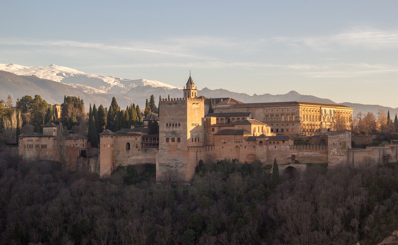
The Sierra Nevadas offer the chance to explore the nearby city of Granada. Granada, also known as the city of a thousand castles is nestled in the foothills of this amazing region of Spain. Explore the famous Alhambra, a palace and fort hybrid, this building is sure to fill you with awe and wonder. Ornately carved Moorish style stonework and wonderful garden courtyards offer a picture-perfect place to immerse yourself in history.
Grenada offers the opportunity to experience both the new and the old. After you’ve wandered the halls of the Alhambra relax outside and enjoy world-famous tapas and drinks. Get lost in the white-walled houses of the Realejo district. Meander the streets of Granada and spot some of the city’s graffiti art. The night life of Grenada, like much of Spain, pulses into the wee hours of the morning. Get lost in the music with clubs and tapas bars galore.
The Basilica San Juan de Dios is well worth a visit. Even if you aren’t interested in baroque churches, this one is sure to impress with its opulence. Every square centimeter seems to be cladded in gold or ornately painted scenes. This church will take your breath away.
While in southern Spain one must stop in Seville. Roman ruins act as a reminder to just how ancient this place is. The Moorish certainly left their mark as well. The Alcazar, one of the most famous landmarks of the city, was built in the 1300s during the dark ages. However, this fortress is anything but dark. The stunning architecture exemplifies Moorish crafstmanship. Three-dimensional stone relief carvings cover the property. Stroll through Parque de Maria Luisa and enjoy the fantastic water gardens and lush shade trees. When the evening comes, check out a Flamenco concert at the Musea del Baile Flamenco. Surround yourself with the heart of Spanish culture in Seville.
About the Sierra Nevada
The Sierra Nevada means "snowy range" in Spanish, its many peaks include the highest point of continental Spain, Mulhacén (3478m), and more than 20 others over 3000m.
The range was formed during the same events as the European Alps and the the Atlas of North Africa, with the Iberian and Eurasian plates being impacted by the African plate. The geology of the area is made up of tertiary alpine formations. of snowy peaks, abundant sunshine and a warm Mediterranean coastline.
The cities of Granada, Almería and Málaga are all in the vicinity and the Sierra Nevada National Park was formally established on 14 January 1999 and range is also designated a UNESCO Biosphere (1986).
The range is part of the wider mountain belt known as the Baetic System, winding along Spain's Mediterranean coast. The broad geography of the range is one of a ridge running broadly west-south-west to east-north-east. To the South, several long but narrow river valleys lead off towards the south-west, separated by subsidiary ridges. The characteristically steeper northern aspect, has a less orderly array of valleys and ridges, feeding the Genil River below.
The climatic conditions in the region vary enormously throughout the year and by elevation above sea level. Summer in the valleys can be swelteringly hot and winter on the peaks is sufficient to allow skiing and winter mountaineering with temperatures as low as -35degC. Rainfall varies greatly with altitude from 350mm to 1600mm annually.
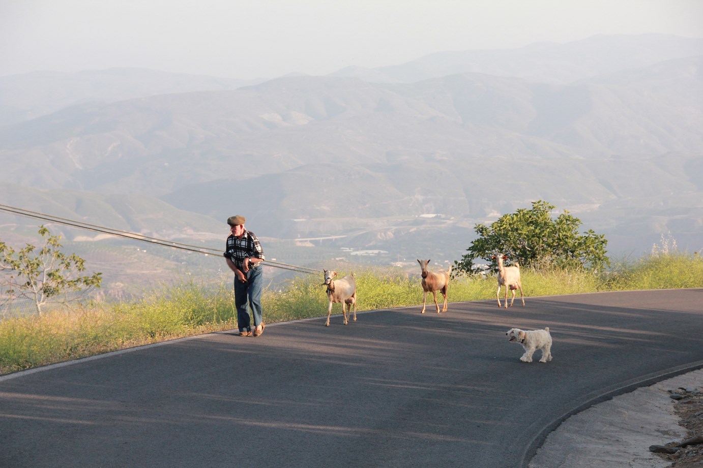
There is a wealth of wildlife throughout the range including 64 endemic species. A visitor stands a good chance of seeing Spanish ibex mountain goat, rabbits, hares and squirrels. It is also home to foxes, badgers, martens and wild cats although you would be very lucky to catch a glimpse of these shy creatures. In the blue skies above you there can often see Royal Eagle, Golden Eagle, Bonelli’s Eagle, Common Kestrel, Little Owl and Eurasian Eagle-owl. There are also many other smaller birds and fowl and also lizards, frogs, toads, dragonfly and butterfly.
The range of vegatation is huge, as one would expect from an environment encompassing everything from dry sub-tropical zones through orchards, meadows, alpine and barren rocky peaks. Lower zones play host to juniper and gorse, higher up are the figs and olive trees, higher again are the oaks, chestnuts, poplars before giving way to scots pine and alpine flowers such as crocus and violet.
Walking Guides and maps for the Sierra Nevada
Sierra Nevada - La Integral de los 3,000, Editorial Piolet, 1:25,000, ISBN 9788493787493
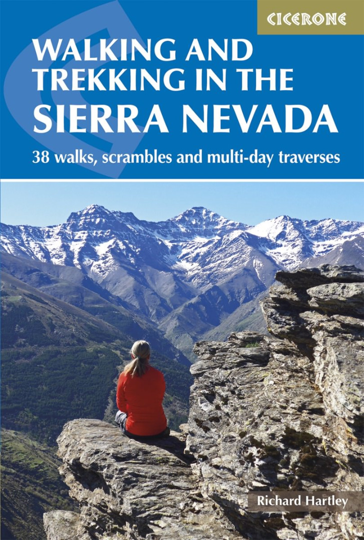
Walking in the Sierra Nevada, Cicerone, Walmsley, ISBN-10: 1852844353, ISBN-13: 978-1852844356
Walk! The Alpujarras, Discovery Walking Guides, Davis, ISBN 1-904946-23-2
Sierra Nevada - Alpujarras Walking Guide, Discovery Walking Guides Ltd, Brawn, ISBN-10: 1899554378, ISBN-13: 978-1899554379
Sierra Nevada, La Alpujarra Map and Hiking Guide, 1:40,000 Illustrated Map, ISBN-10: 8480902558, ISBN-13: 978-8480902557
Alpujarras Tour & Trail Map, Discovery Walking Guides, (waterproof) 1:40,000, ISBN 10: 1904946259, ISBN 13: 9781904946250
Sierra Nevada: Alpujarras/Marquesado del Zenete, Editorial Penibetica, 1:40,000, ISBN: 9788493444938
GR 240: Tour of the Sierra Nevada, Editorial Penibetica, 1:40,000,
Sierra Nevada - Las Alpujarras, IGN, 1:100,000,
Dates & Bookings
Itinerary
Day by day itinerary
| Day | Elevation | Travel Time | Info |
|---|---|---|---|
| 1 | Fly to Malaga and transfer 2.5 hours to either Lanjaron or Güejar Sierra in the mountains for overnight in hotel (half board). | ||
| 2 | Ascent - 2055m. Descent - 565m | 6 hrs |
Güejar Sierra or Lanjaro - Lavaderos de la Reina. The path steepens before contouring around to the bowl at the Lavaderos de la Reina where there are some small lagunas, streams and a small waterfall. Here we will set up camp for the night. |
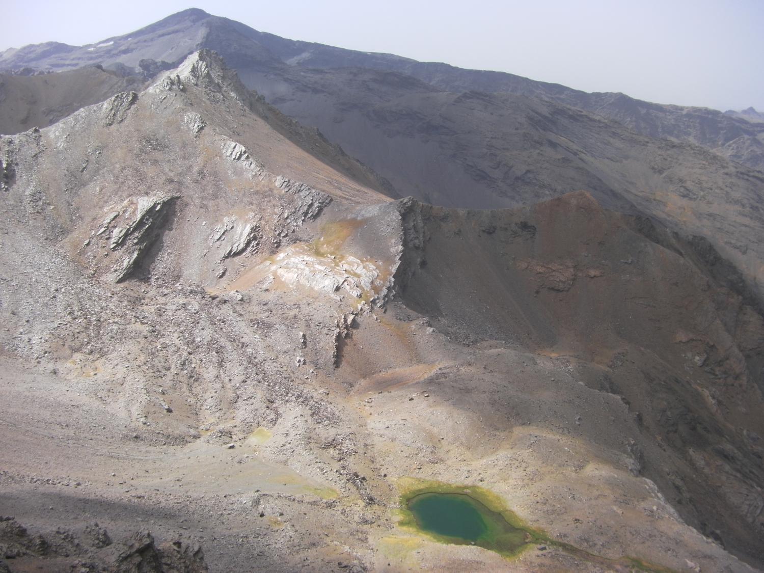
| 3 | Max 3154m | 6-7hrs | Lavaderos de la Reina - Lagunas de las Calderetas. Today starts with a long ascent up to the main ridge of the Sierra Nevada, emerging at Picon de Jerez our first 3000m peak. It is an easy walk around to the next, Puntal de Juntillas. From here an optional 1hr detour to the 3182m peak of Horcajon. Follow the main ridge around over Buitrera and over some rough bouldery ground to Atalaya and a steep descent and climb through a small col before another optional 45 minute detour to Mojon Alto. Another descent and re-ascent through the Vacares col brings us to the bouldery summit of Puntal Vacares. We can then take a fairly direct line down to the Lagunas de la Calderetas where we will make camp for the night. Depending on the availability of running water, we may camp at the upper lagunas or drop down to the streams below. |
| 4 | Max 3369m | 6.5-8hrs | Lagunas de las Calderetas - Siete Lagunas If anyone is keen, we can start the day with an up-and-back climb to Puntal Goteron, just above the camp. We then set off downhill to skirt around the huge north east face of Alcazaba before climbing up onto it and following its line on up to the peak of Alcazaba, 3369m. This long but spectacular ascent will probably take most of the morning. We can also make an optional short detour to the peak of Penon Globo on the way up or down. After visiting Alcazaba's summit we cross to a steep and loose descent down to the Sieta Lagunas. There is another optional up-and-back detour from here up to Puntal de Siete Lagunas before we set up camp next to one of the many lagunas to choose from here. |
| 5 | Max 3479m | 7-10hrs | Siete Lagunas - Laguna Lanjaron Today we have a similar start to yesterday as we make our way down to outflank the north east face of Mulhacen before climbing up onto it and following it up to the summit. The climb is shorter and easier than yesterdays and the views from mainland Spain's highest point more than compensate for the effort. The descent down to Mosca col is made considerably easier by the well made path. From the col we have the option of around a 45 minute detour out to the spectacular outlying peak of Juego de Bolos. From here you get a great view back to the north face of Mulhacen. Moving on to the Vivac de Caldera refuge we have another optional ascent of the very steep and loose scree to Puntal de la Caldera, the highest point on the spectacular curving caldera rim. We then make a rising traverse up and around the bowl of the caldera to the peaks of Loma Pelada then an easy descent to the former road along the Crestones ridge. We follow this track around and through the notch in the Respones ridge and below the steep and loose face of Cerro de Los Machos. As the track rounds the shoulder we have the option of an hour or so detour up to the summit of Machos before continuing on the track around to Carihuelo col and refuge. From here we have an optional ascent of Veleta, which takes at least an hour, before we drop steeply down to the Lagunillas de la Virgen and follow the well made trail around and back up to the Elorietta refuge. From here we have the option of yet another out-and-back detour to the peak of Tajos Nevero. We then drop down to camp at the Laguna Lanjaron in the valley just below the refuge. |
| 6 | Max 3152m | 4-6hrs | Laguna Lanjaron - Pena Caballera - Mairena This morning we start by climbing back up to the main ridge near Elorietta before following it over Tozal del Cartujo and a whole series of undulations before our final 3000m peak of Caballo. It is then almost all down hill, either keeping just west of the main ridge or dropping into the valley to the east, to our pick-up on the 4x4 road just below the Pena Caballera. From here we will drive down into Lanjaron before changing vehicles to drive across to the village of Mairena and our hotel. |
| 7 | Mairena We will stay in a beautiful hotel called Las Chimineas which is perfect to allow us to relax and also have the opportunity to experience some of the local cultural and gastronomic highlights. Potential activities include; A visit with history talk to the local ancient church / mosque at Jubar, visit and talk about local farming techniques at Las Chimineas' own organic farm and a visit to Mairena olive mill. |
||
| 8 | 3-4hrs | Mairena - Malaga airport After savouring a last slow continental morning and lunch we will drive back to Malaga for evening flights back to the UK. |
Cost
INCLUDES
- Group airport transfers (to/from Malaga airport)
- Local trekking guide
- All meals on trek
- Tents, stoves, cooking equipment
- Mules to carry main bags and food on trek
- Transportation of travel & leisure clothes and spare kit from Lanjaron to Mairena
- Two nights full board accommodation in Las Chimineas hotel
EXCLUDES
- International airfare
- Travel Insurance
- Extra days food and accommodation
- Airport transfers if not travelling with the main group
- Evening meal in Lanjaron on day 1
Note: Do register for the European Health Insurance Card (EHIC) which has replaced the previous E111 scheme, or in the event of the card not being valid in Europe following Brexit, adequate travel insurance.
Photos

Choose a scheduled date or contact us to set up private dates or a bespoke itinerary. The minimum deposit is £100.00 and the balance is due four weeks before travel.
- Duration 8 days
- Numbers 4 min
- Altitude 3478m
- Challenge Moderate to tough
- Distance 75 kms