


North and South Base Camps Kanchenjunga Trek
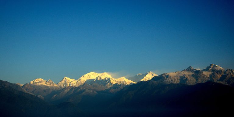
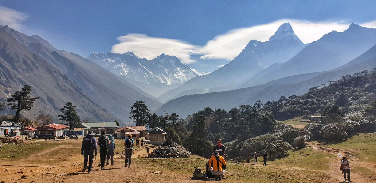
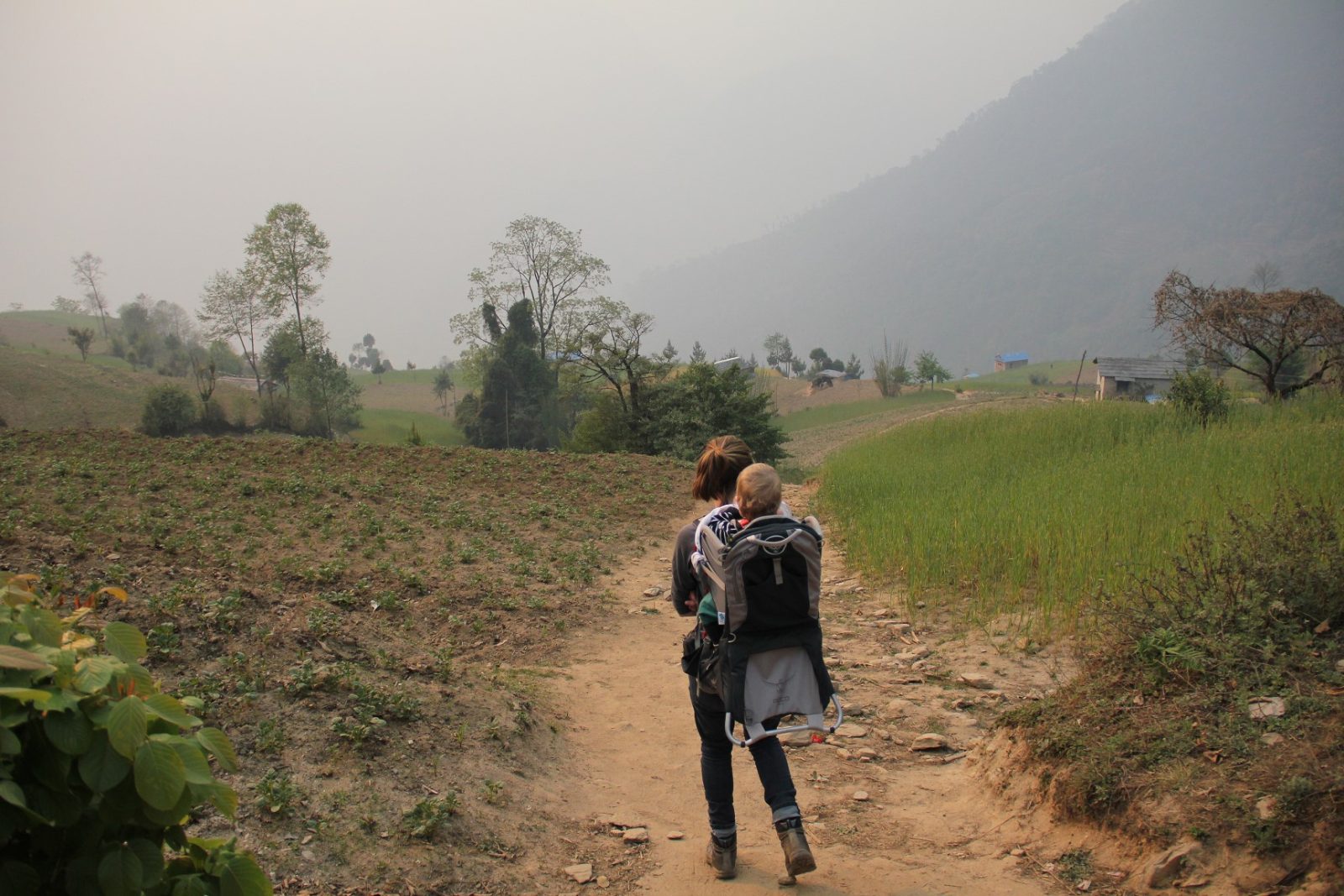
Our Kanchenjunga base camp trek is a superb 26 day holiday in the east of Nepal, with 21 days of actual trekking covering 220 km in an area which is far less visited by tourists and includes a wide range of wonderful scenery from lush, tropical jungle through to rhododendron, chestnut and oak forests and high onto the glaciated base camp of the third highest peak in the world.
Overview
Visitors numbers to this trekking area are restricted, so to trek in Kanchenjunga, you need a local guide and at least 2 trekkers fulfil and gain the necessary permits.
This trek visits both base camps on the north and south side of the mountain and is generally run for small groups of people looking for custom dates; we provide experienced advice and preparation for the trek and a high level of professionalism and care on trek with excellent staff.
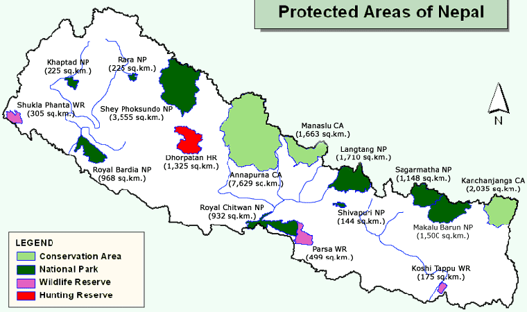
The route to Kanchenjunga Base Camp passes through the Arun valley which is considered one of the most beautiful regions for trekking in Nepal, and one of the highlights is the Kanchenjunga Conservation area which covers an area of 2035 square kilometres.
What Our Adventurers Think:

I had a fantastic trip and was looked after wonderfully in Kathmandu by Pasang and, on the trek itself, Lopsang and Tendi were brilliant, nothing being too much trouble and always attentive and helpful – you have a great team out in Nepal. I have some very special memories of my trek – the stunning scenery, the walk itself, the people I met on the way and the marvellous sense of achievement at reaching my goal by arriving at base camp; thank you once again for organising it for me.


Kanchenjunga Base Camp Trek
The video shows the route on google map visiting north base camp first and then to the south side.
Have a look at these two videos of some trekkers who first went to the North base camp and then the South base camp. They both show the level of trekking, the habitats passed through and the trails very well.
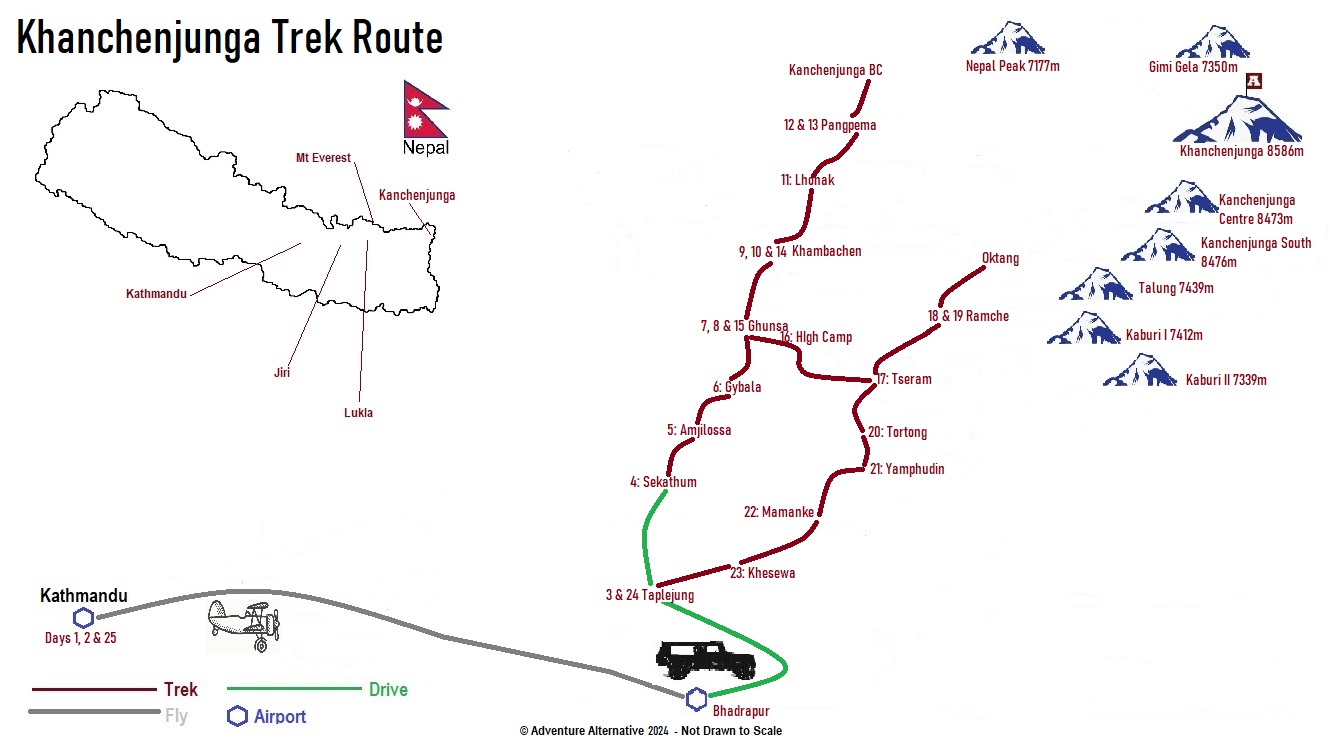
Kanchenjunga Base Camp Trek Itinerary
The trek begins at Taplejung which is a 45 minute flight from Kathmandu to Bhadrapur, followed by a jeep to Birtamod and then to Taplejung. The broad itinerary for the whole trek is below, and we visit the north base camp first.
This walk around Mount Kanchenjunga visits both the North and South Base Camps. The route begins by approaching the North side of Kanchenjunga where you will have great views of Tent Peak, Nepal Peak, Cross Peak before the bulk of Kanchenjunga itself becomes visible.
From Pangpema on the north side the trek returns to Ghunsa and then crosses Mirgin La pass over to the south side of Kanchenjunga. Once over this pass, you follow the route through Ramche and Oktang where there are impressive views of the South West face of Kanchenjunga.
Arrive Kathmandu. Transfer to your choice of hotel. Rest and relax.
Rest day and trek briefing day plus enjoy the vibrant city (we can organise a tour for you if requested either pre or post trek).
Fly from Kathmandu to Bhadrapur followed by a drive to Taplejung. This is a long day, but the drive is enjoyable, with plenty to look at as we journey through the lower regions and communities of the Himalaya in the far east of Nepal.
We continue our journey by road to reach our trek start point of Serkathum (on some maps Sukethum). We can then relax in the afternoon and prepare for the trek starting the following day.
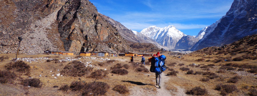
Our first days trek is an enjoyable journey, initially downhill before a gradual ascent that sees us undulate along the terrain whilst crisscrossing the Ghunsa river over several bridges before reaching the village of Amjilossa. Our destination is a quaint village, with welcoming locals and set in an idyllic forested environment with panoramic views. This is a great day to settle into our new daily routine of peaceful walking.
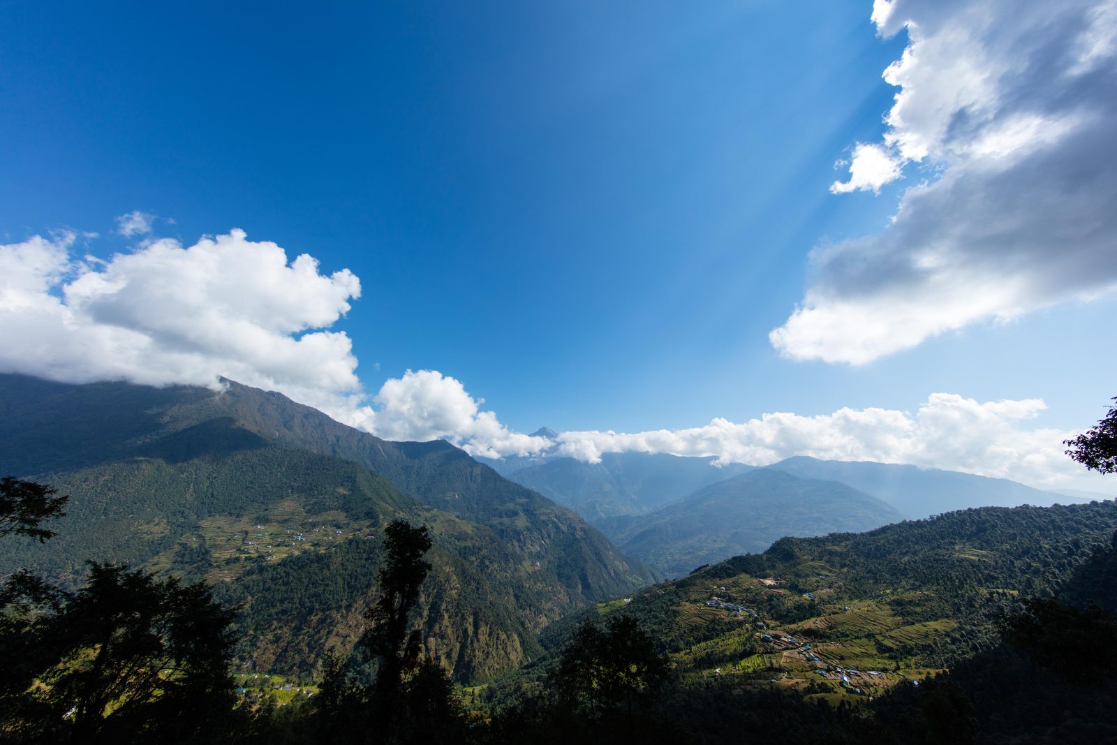
Today, in terms of terrain, is not indifferent to the previous day as we continue our journey towards Kanchenjunga. On leaving Amjilossa, there is a short ascent through oak, bamboo and rhododendron forests offering a great view of the south western side of Kanchenjunga. The route makes numerous steep climbs and short descents and passes a beautiful large waterfall before the final steep climb up to Gybala.
From Gybala, the trail carries on to the village of Kyapra and then climbs easily up the right bank of the river. The trail crosses a large meadow past a few villages and ascends a gentle hill before descending across the river into the beautiful village of Ghunsa. This Tibetan village has several lodges, gompas and shops where you can buy a few souvenirs.
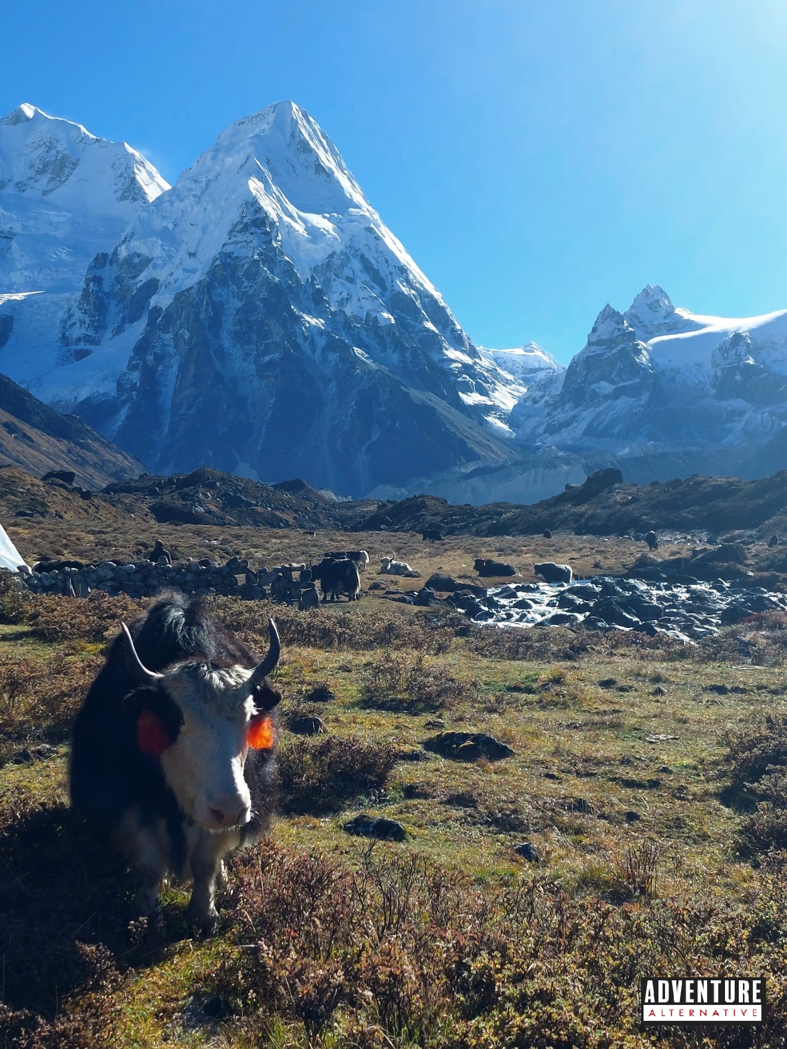
Today we will have a rest and acclimatisation day. The village is nestled in a deep valley surrounded by towering peaks including Kanchenjunga, Kumbhakarna, Jannu, and many others. There are a number of walking routes for us to choose from allowing us to gain some altitude and enjoy the rugged terrain, deep valleys, glacial lakes, and pristine forests that surround the village. It offers up some dramatic scenery, which we can enjoy before returning to Ghunsa to relax in the afternoon.
The route climbs gradually along the south bank of the Ghunsa Khola, through beautiful rhododendron and pine forests, passing many mani walls, colourful prayer flags and chortens along the way. The trail climbs steeply up scree slopes to reach the Tibetan settlement of Khambachen, providing wonderful views of the huge north face of Janu.
Khambachen is the perfect place to again take some time to relax and acclimatise. During our rest day we can ascend to almost 4600m to the Janu View point and enjoy great views of Janu Himal (Kumbhakarna) at 7710m, the Janu glacier and several other peaks. The valley views, wildlife alongside the peaks makes for a great few hours walk. Janu viewpoint is also known as Phaktalung, which is a holy place for the Limbu people. There is a huge stone and a small temple there which thousands of pilgrims visit during the full moon festival in August.
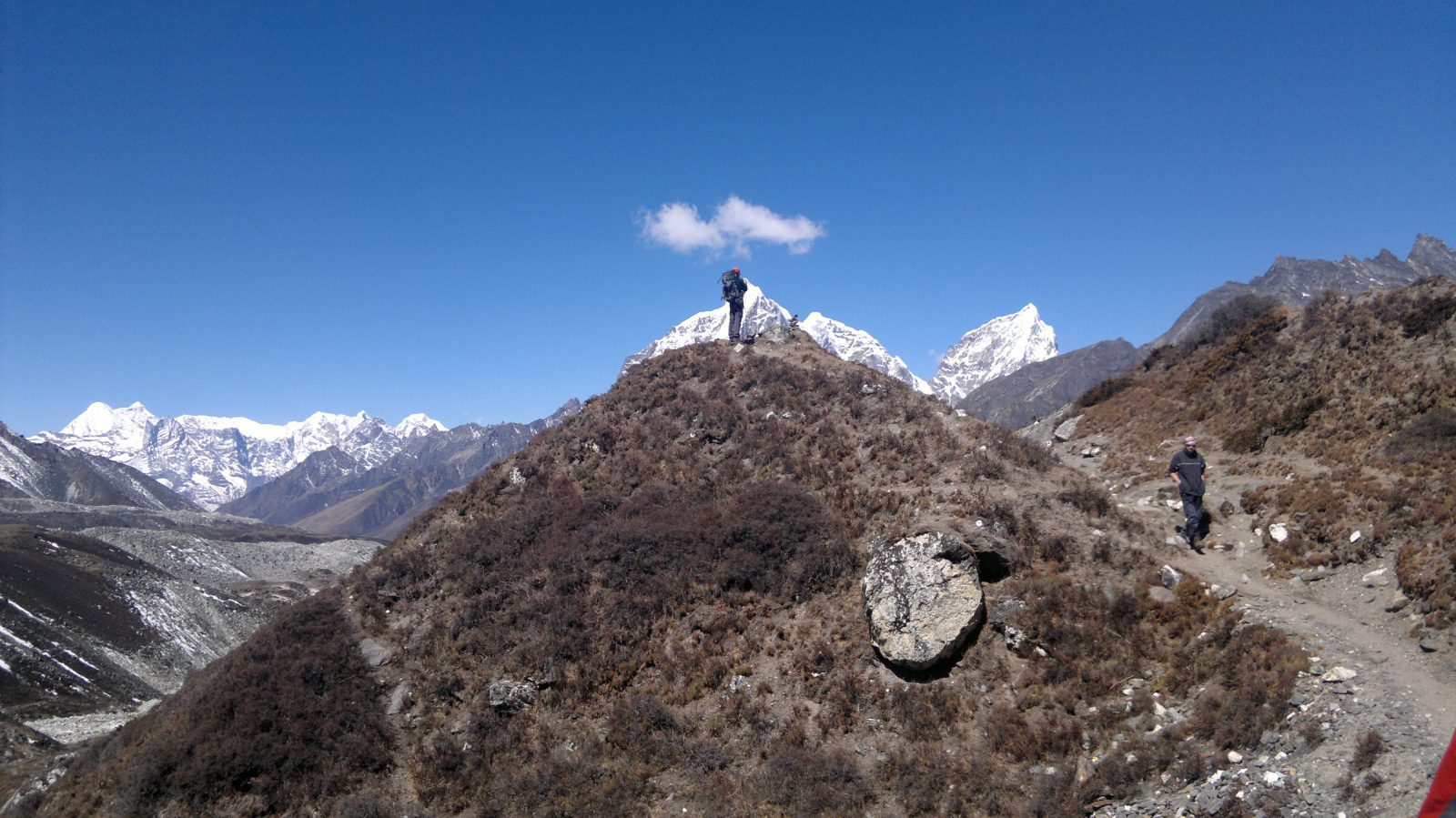
From Khambachen the trail climbs up through exposed rocky fields to the village of Ramtang and then crosses North West of the Kanchenjunga Glacier and past large stone huts to the village of Lhonak. From Lhonak there are impressive views of the Himalayas, including Wedge Peak (6750m), Mera Peak (6344m), Nepal Peak (6910m) and Twins (7351m).
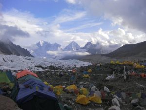
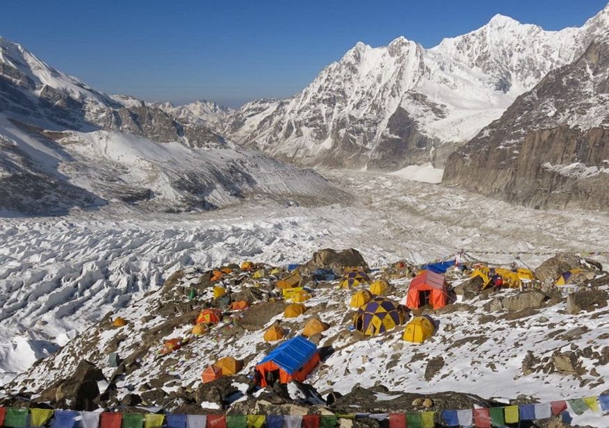
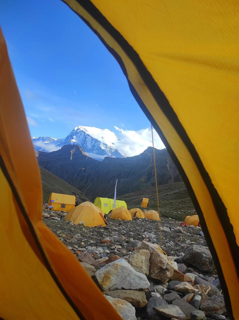
An early start for the trek to the Kanchenjunga north side base camp at Pangpema (5143m). This is a real high point of the trek not just in altitude but also for majestic views of Tent Peak, Nepal Peak, Cross Peak, the Twins and the impressive Kanchenjunga! We’ll enjoy the area and stay overnight.
We’ll take some more time to trek around this stunning region and absorb all of the mighty peaks and atmosphere. This circular hike takes around 4hrs, before a 3hr descent back to Lhonak.
Following back along the same path for around 4 hours.
Following back along the same path for around 4 hours.
From Ghunsa, the trail climbs steeply 500m to the high camp, for an overnight stay in preparation for the trek to Mirgin La Pass.
This is another impressive day with views of the Himalayas. Our route crosses five passes – first Tamo La (3900m), an unnamed pass (4115m), Mirgin La (4663m), Sinion La (4660m) and another unnamed pass at 4724m. From this last pass there is a steep descent of 1000m to the small settlement of Tseram, high above the Simbua Khola.
The walk from Tseram to Ramche is extremely scenic and is one of the best sections of the Kanchenjunga Circuit trek. The route passes the nose of the glacier into a valley, offering magnificent scenery and views of all the peaks to the east along the India-Nepal border, such as Koktang (6147m), Rathong (6679m) and many more above 7000m. It then follows along a lake, meadow and stone houses to reach Ramche, for an overnight stay.
Leave early in the morning and follow the ablation valley to Oktang for a view of the south face of the magnificent Kanchenjunga and the climbing route to the summit, first climbed in 1953. From Oktang, the views of the surrounding Himalayas are incredible; the whole cirque is above 7500m. Many people rush this day but we like to take our time to asborb and enjoy this magical place. After spending some time in Oktang, we trek back to Ramche to rest for the evening.
The trail descends steeply through until we drop down enough altitude to again enter stunning rhododendron forests that lead to Torontan. We then climb up through mossy forest to reach the pass at Lamite Bhanjyang. From here, there are fantastic views of Kanchenjunga and Jannu. We drop further to Tortong for our overnight stay.
The trek descends over 900 metres today, beginning with a steep descent to Imja Khola, and then crosses along the Dubi Pass. From here there is a further but more gradual descent for a couple of hours until reaching the village of Yamphudin. This village is home to Sherpas, Rais, Limbus, and Gurungs.
From Yamphudin, the trail descends steeply to the Kabeli Khola River and crosses a log bridge before reaching the village of Mamanke, where we will stay overnight.
From Mamanke we return to the road and travel by vehicle to Kanyam. This is an 8 hour journey and we have time to stop and take in the views. It is interesting to see this region as we pass by every day life in the Himalayan foothills. We’ll overnight in a local lodge.
We depart circa 6am to reach Bhadrapur mid afternoon before an early evening flight back to Kathmandu, where you will stay in your hotel of choice.
After an evening arrival on day 24 you can spend the day exploring on a Kathmandu City Tour.
It is possible to fly out this day too, however the trek relies on an internal flight, which can at times be delayed. It is best, if possible to allow at least one extra day in Kathmandu at the end to accommodate delays.
Fly home on an am or pm flight.
Ready for an Adventure of a Lifetime?
Choose a scheduled date or contact us to set up private dates or a bespoke itinerary. The minimum deposit is £200.00 and the balance is due six weeks before travel.
Fixed Itineraries
| Start Date | End Date | Days | Price (per person) | |
|---|---|---|---|---|
| 04/04/2026 | 28/04/2026 | 25 | £2,895.00 | Book Now |
| 02/05/2026 | 26/05/2026 | 25 | £2,895.00 | Book Now |
| 26/09/2026 | 21/10/2026 | 26 | £2,995.00 | Book Now |
| 30/10/2026 | 23/11/2026 | 25 | £2,895.00 | Book Now |
Private Itineraries
Our Kanchenjunga Trek Experts
Pasang Tendi Sherpa is one of the company directors in Nepal and a mountain leader. He has been working with Adventure Alternative since 2005 and has made three climbs of Mount Everest with Gavin.
He lives in New York with his wife Sarasoti and their two children Jubilee and Elli Dolma, and he travels to Nepal during the trekking seasons and helps manage the company and run some treks and climbs.
He has had plenty of experience managing expedition and...
Kanchenjunga Base Camp Trek - £2,895 per person Based on 3 people
Inclusions
- Airport transfers
- All accommodation in lodges/tea houses (twin rooms) and in tents on the camping days
- All meals on trek, either from the menu in the lodges or prepared by our staff at the camps
- National Park Fees and permit for Kangchenjunga area
- Sherpa guides (English speaking, trained in first aid) and porters
- Internal flights as per the itinerary
- Staff insurance
- First aid kit and group equipment
Exclusions
- International flight to Kathmandu
- Hotel in Kathmandu – we have a choice of options available during booking or you can book yourself
- Personal costs on trek – hot and cold drinks, hot showers, charging, wifi, snacks.
- Additional treks, tours or visits outside of the itinerary
- Travel Insurance
- Visa
- Tips
The price is based on minimum three people, it will be more expensive for a solo traveller and may be a discount for larger groups. We offer quality, service, security and an ethical stance on tourism in a developing country. We don’t want to be so expensive to end up running fewer trips and have our staff idle, but on the other hand we can’t run cheap trips that compromise standards and promote the practise of skimming budgets which would result in the porters getting next to nothing. We also do not operate kitties because we believe it is better to offer an all-inclusive price that reassures people they have all their accommodation and food covered.
Additionally we plan treks with sufficient rest days and with achievable daily altitude increases in order to acclimatise. Reducing the number of days may make the price cheaper but the chances of successfully completing the trek also greatly reduce.
We include professional staff and a porter for each member.
We have our own licensed company in Kathmandu, Adventure Alternative Nepal and full time staff to operate all our treks, climbs and tours in Nepal.
Length and Terrain of the Kanchenjunga Base Camp Trek
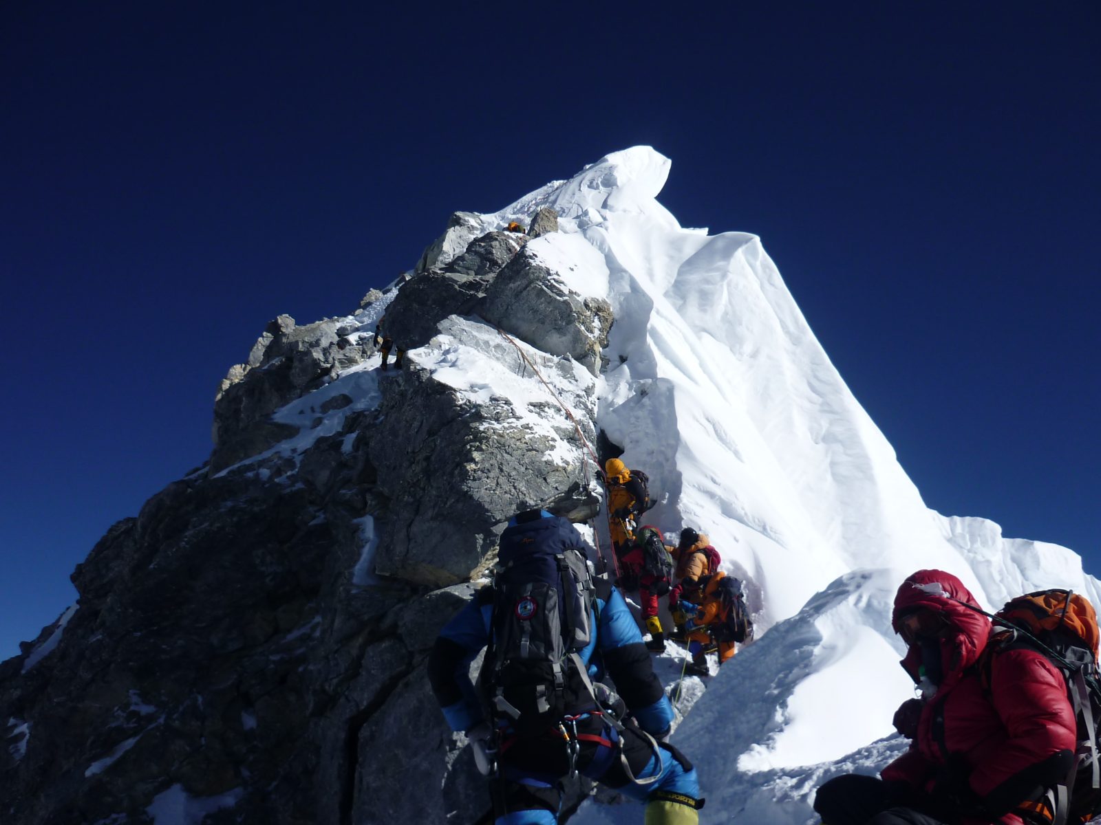
The Kanchenjunga trek is long (220 km) and quite strenuous, requiring a good level of fitness needed for three weeks of sustained walking with a light backpack. The terrain is often rough with rocky paths and some long hills and there are a few areas around the base camps where it might be necessary to use short ropes to aid moving across rocky terrain. These are for safety and assisting people over short rocky sections. However there are no climbing skills needed for the trek.
The mountain tracks are easy to follow; early on they follow the rivers and valleys and then ascend abruptly over ridges and shoulders, which means steep sets of rough steps and zig zags uphill.
It is a remote area with little access to medical help, so being fit and having good boots and being used to hiking many days carrying a pack is an important requirement. Training at home with pack on by going on long walks is a good start, plus some leg exercise in the gym and swimming for cardiovascular fitness. Since this is a long trek, do get a health and dental check before going.
When approaching Base Camp, the exposure to altitude makes the walking harder and the likelihood of altitude sickness higher, so it’s necessary to allow rest days and walk slowly. The trek will have a wide range of temperatures depending on the altitude and the time of day. In the mountains between 1,000m and 3,500m, the nights will be cool, normally around 5ºc, and during the day temperatures sometimes rise to 25ºc. At higher altitudes temperatures range from about 15ºc to -20ºC at night so it will be important to have a good selection of clothing to provide layers and protection against the cold and the sun.
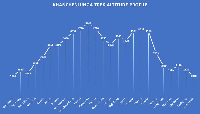
Kanchenjunga Base Camp Trek Altitude Profile
Accommodation on the Kanchenjunga Base Camp Trek
Accommodation is in lodges which offer western and Nepalese food and sometimes camping when our staff will cater for you. At places on this trek the lodges will be more rudimentary than in the Khumbu region and more likely to offer only Nepali food, which means lots of rice and dal bhat. We recommend using boiled water on the trek or using good quality water purifiers, and we do not recommend buying bottled water in plastic containers.
The itinerary is designed to allow for optimal acclimatisation to the altitude gain, and we do carry drugs like Diamox and Dexamethasone for managing high altitude sickness. Our staff are also trained in mountain first aid. The best advice is to go slowly, eat well, drink well and sleep well. There are no vaccinations needed for visiting the Kanchenjunga region.
Packing List for the Kanchenjunga Base Camp Trek
The basic idea of the kit is to keep you warm, dry, protected from the sun, able to move efficiently on the mountains and able to be comfortable in the evenings and night. Your daypack should weigh around 8 – 10 kgs and your main duffle bag should weigh around 15kgs.
Generally speaking a good pair of trekking boots, thermal wear, fleece jacket, down jacket, light weight wind cheater, trekking trousers and shorts, long sleeved and short sleeved T-shirts, duffle bag and day sack, gloves, enough pair of socks, sunglasses, headlight, woollen beanie caps, water bottles, personal toiletries, gadgets and books.You can split your requirements into sections:
- BAGS – Duffle bag ~80L (for a porter) + Medium Daypack ~40L (carried by you)
- SHELL – Top and bottoms to keep dry from wind/rain/snow
- INSULATION – Warm layered system of fleeces, trousers, tops and gloves and hats for sun and cold
- BASE LAYER – Thin layers to wick away sweat and wear on very cold mornings or evenings
- FEET – good quality waterproof ankle high boots and camp/lodge shoes
- SLEEPING – Warm 3 to 4 season sleeping bag and a full length sleeping mat
- DRINKING – Water bottles and purifiers
- WASHING & MEDICAL – wash kit and personal first aid and items for personal hygiene
We recommend reviewing our Nepal Trekking Kit List Guide so you know what you’ll need for this journey
Kanchenjunga Trek Review
“Just a quick note to say thanks for getting my “missing bag” up the mountain for me. What initially looked like a disaster at the start of my trek turned out to be the most fantastic 3 weeks I have ever spent anywhere so far. The whole trek just blew my mind, from the culture, scenery and most of all the people, especially the Adventure Alternative sherpas & porters. I dont think I could praise enough the likes of Pasang, Jangbu & Gelgun who looked after us at times above & beyond the call of duty. Please pass on my sentiments to all of the crew out there”. (Richard O’Donovan)
Frequently Asked Questions


Key Information & Guides
General Nepal Information
Health and Safety Guides
Preparation & Kit Guides
Book Your Adventure of a Lifetime Now
Discover our trips to other Countries
Other Trips You May Enjoy
Chulu East Peak
| 21 | |
| 6584 m | |
| Difficult |
Trip Price £3,725.00
Mount Everest
| 50 | |
| 8848 m | |
| High |
Trip Price $75,000.00
Everest Base Camp Trek
| 17 | |
| 5545 m | |
| 90 km | |
| Moderate |
Trip Price £1695.00 includes trek meals
Our Nepal Posts
We’re dedicated to helping you make the most of your next adventure trekking holiday. That’s why we’ve created our travel blog full of in-depth trekking guides, travel inspiration and other fantastic information. Having done all of these climbs many times already, we want to pass on our wealth of trekking wisdom to you.
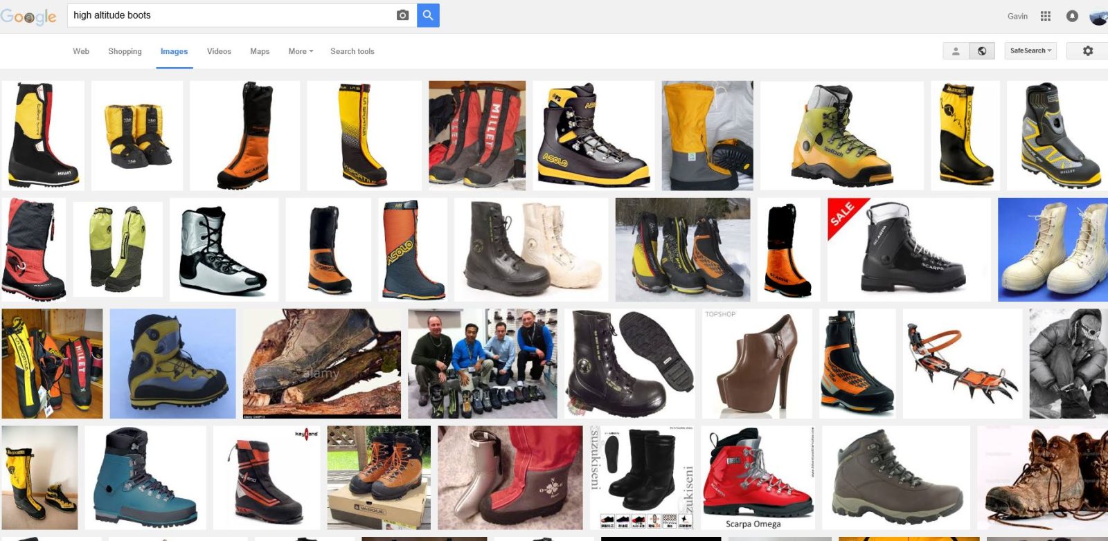
Choosing High Altitude Boots
Twenty years ago things seemed a bit simpler, climbers chose from a narrow range of leather trekking boots and generally a pair of 'double mountain'...
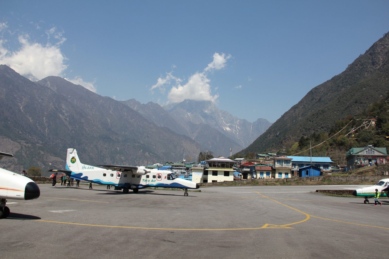
The Road to Everest
It used to be that the quickest way to get to Everest Base Camp was to fly into Lukla airport. Now all that is about to change with the building of...
Trekking With Children in Nepal
There are no rules or laws that restrict children trekking in Nepal and it is the perfect place to combine stunning scenery with an incredible...
How Hard is it to Trek to Everest Base camp?
A trek to Everest base camp is a very realistic opportunity for most people who enjoy the outdoors and have a good level of fitness and...
Trekking With Young Children in Nepal
I remember a friend saying he was looking forward to when his children were six or seven years old so that they could go travelling as a family to...
Accommodation in Kathmandu Guest House
We welcome trekkers, climbers, volunteers, medical students and travellers to the Adventure Alternative guest house in Kathmandu where you can get...