


Mount Kenya Trekking Routes
The following descriptions are a brief introduction to the main routes to climb Mount Kenya.
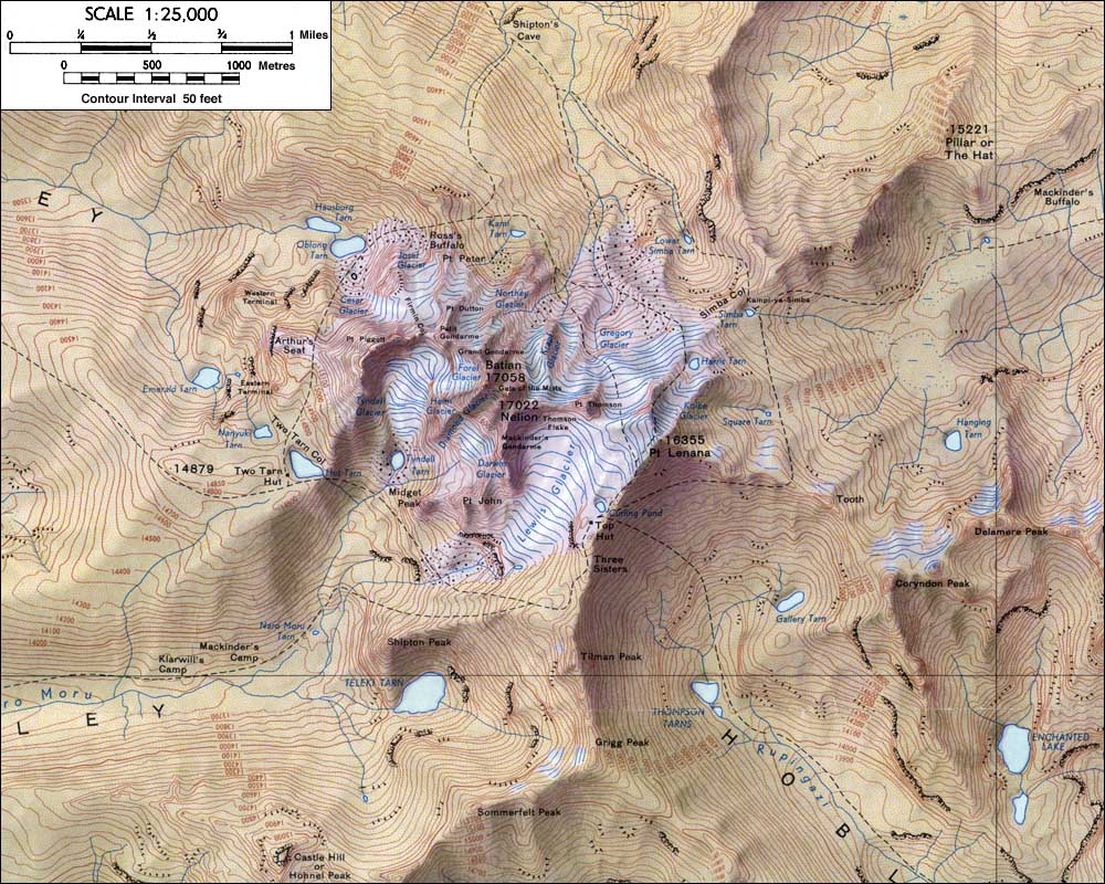
Mount Kenya has three main peaks, the two highest are highly technical (Batian and Nelion) and are rarely climbed in comparison to the third peak called Point Lenana which is a trekking peak. Other peaks on the massif also present interesting rock climbs.
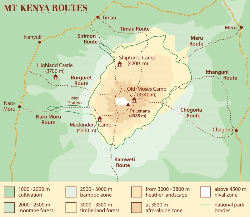
There are three main routes on the mountain that cater for 90% of all trekkers visiting the mountain- Naro Moru to the West, Sirimon on the North West and Chogoria on the South East. Most people go up and down a combination of these three. You can camp or use huts on all three and the trek is normally 5 days to go up to Point Lenana and back down again.
There are a further five routes which are much less climbed – Burguret on West, Timau on the North, Meru on the North East, Ithanguni on the East, and Kamweti to the South. These are all wild camping and the National Park often requires Rangers to attend a group because of wild animals. These routes don’t have official park gates, and route finding is much harder.
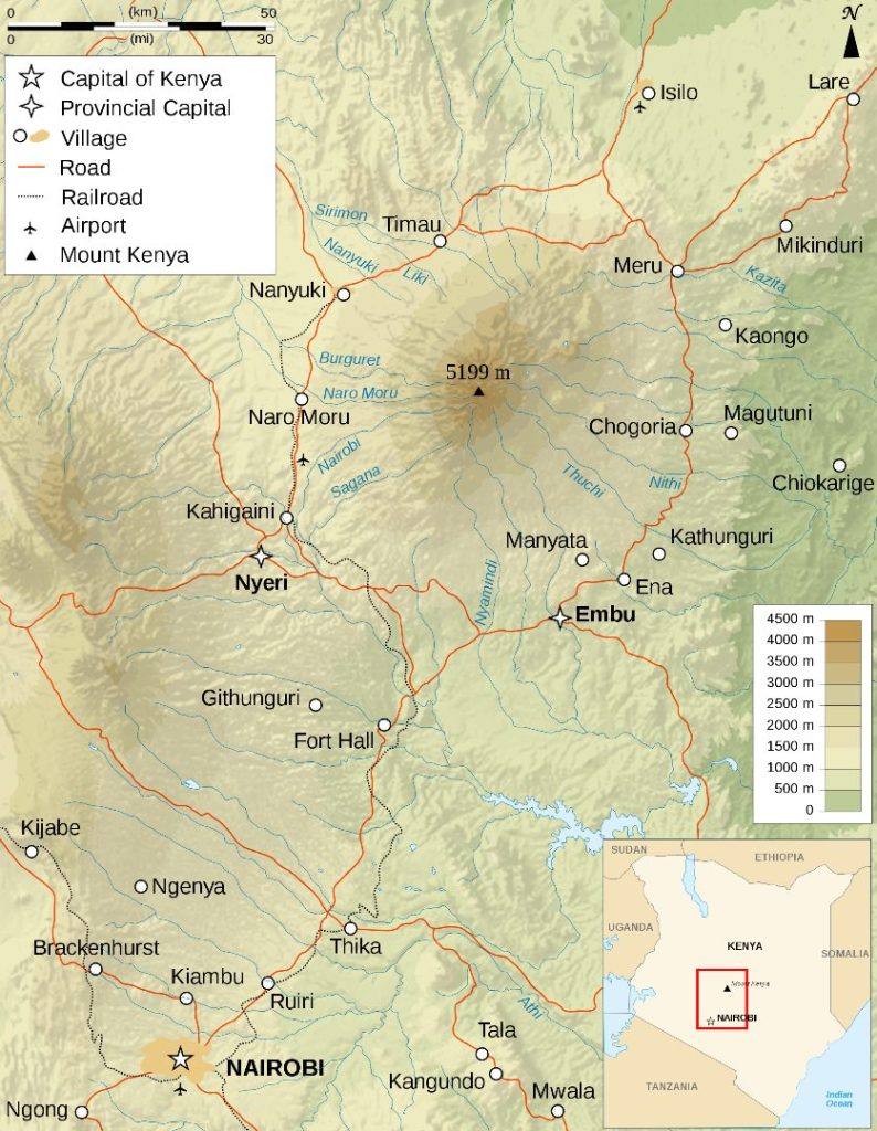
Access is good to the mountain, there is a good road from Nairobi and the journey is about four hours. Most people use Naro Moru as their base on the west side, and Chogoria town or Embu as their base on the east side.
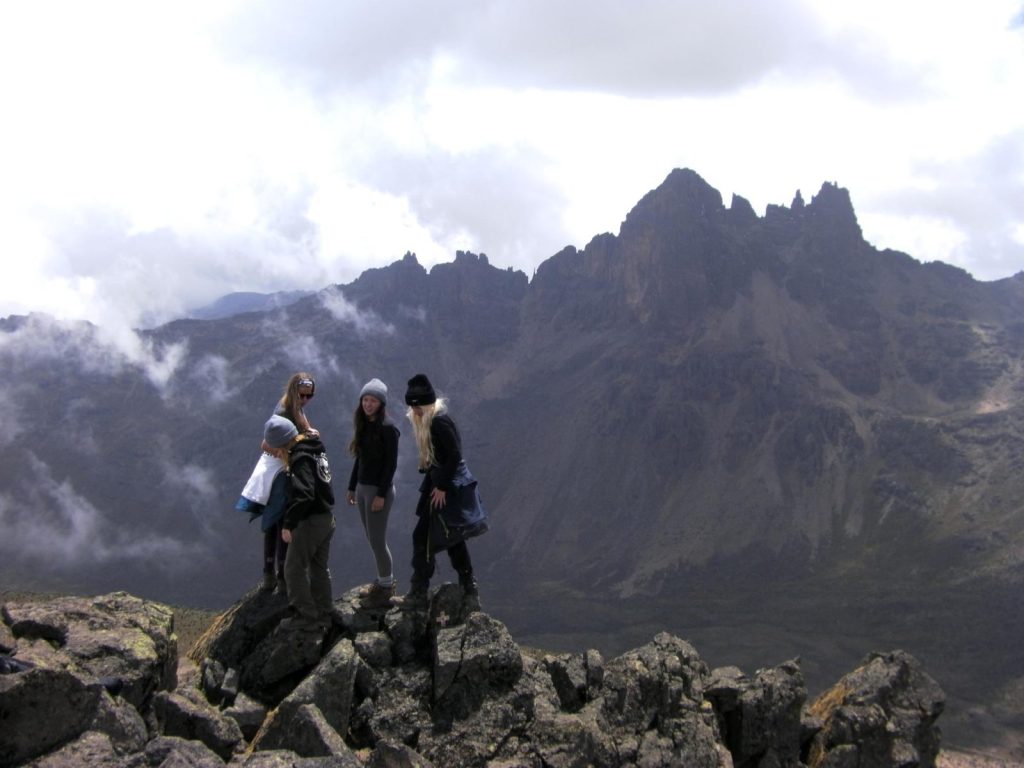
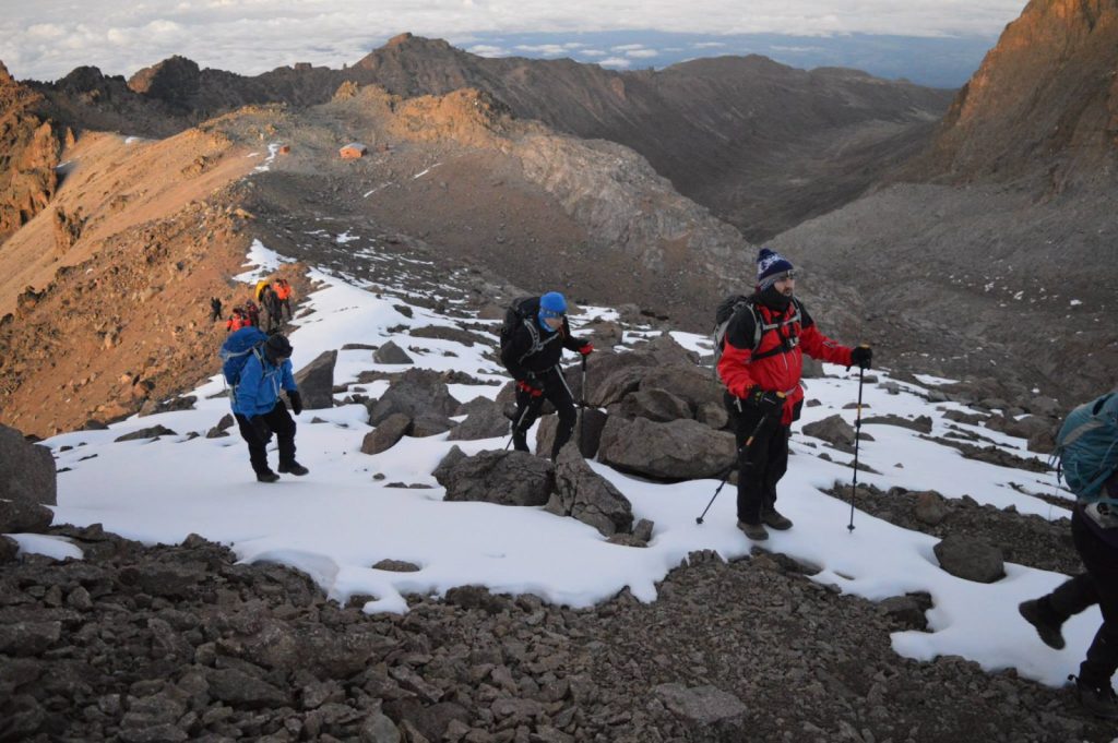
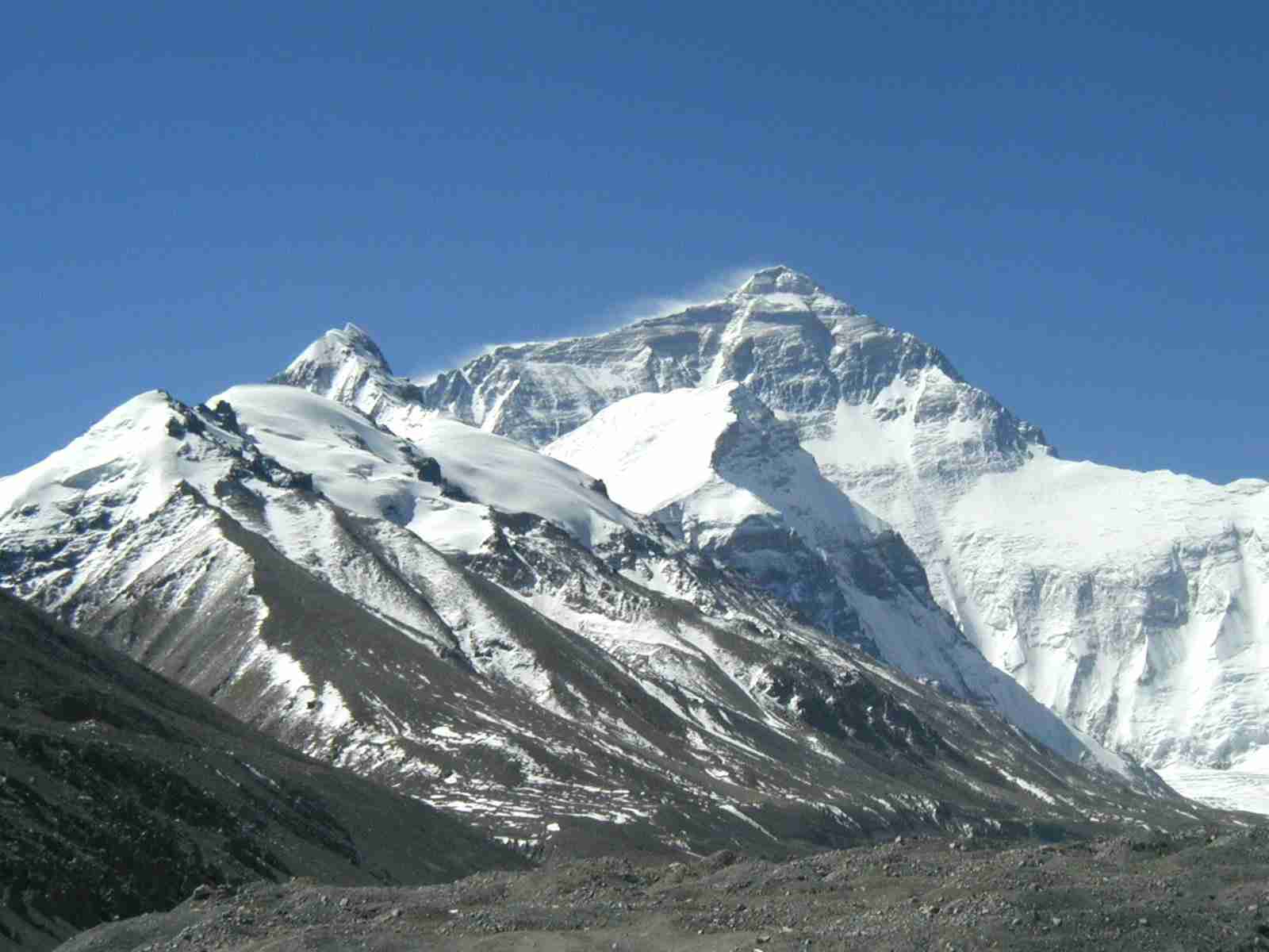
Mount Kenya is an extinct volcano with just one central vent. The main peaks are pretty much in the middle with ridges and valleys that radiate out from the summits like the spokes of a wheel. The routes follow the valleys up to the massif and the trekker then ascends scree and rock to the glaciated summit of Lenana, seen below on the right hand side.
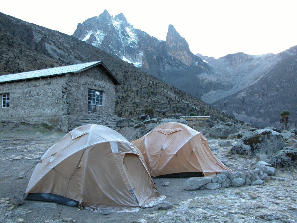
The two main peaks are the remains of the volcanic magma that solidified in the main vent and there is a roughly circular path that goes round them which is the Summit Circuit route. Point Lenana is a smaller sub peak to one side of the main peaks
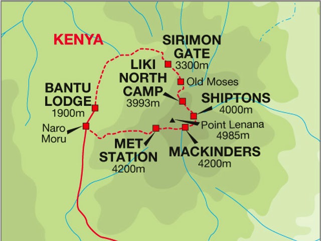
A number of huts are found on all the main routes. The mains camps on the western ascent routes are:
Sirimon – Old Moses Camp, Liki North Camp, Shiptons Camp
Naro Moru – Met Station, Mackinders Camp and Austrian Hut just below Pt Lenana
Route distances
| Name | Starting From | Distance | Start Altitude |
| Sirimon | North-North-West | ~29km | 2650m |
| Naro Moru | West | ~25km | 2400m |
| Chogoria (includes 10km forest trek before Meru Banda’s) | East | ~40km | 2850m/1700m |
| Burguret | West-North-West | ~25km | 1500m |
| Timau | North | ~35km | ~3300m |
| Kamweti | South | ~25km | ~3000m |
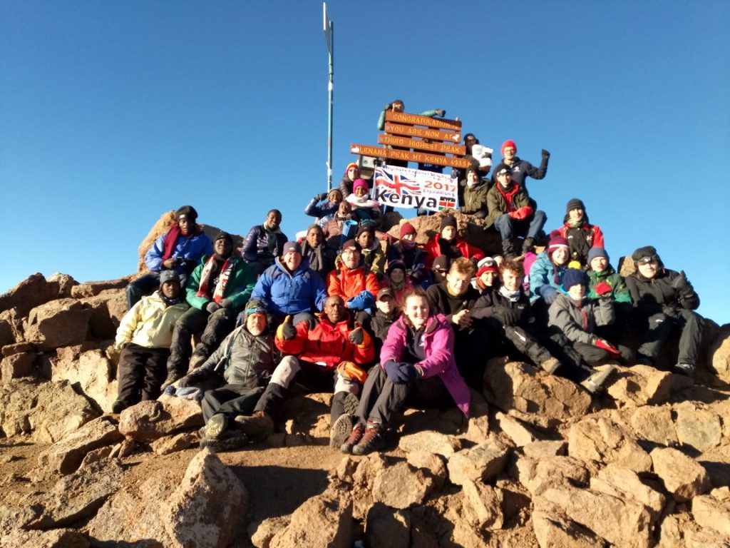
Statistically about 15,000 people climb the mountain every year and the vast majority go to Pt Lenana at 4985 metres, the third peak on the mountain which is moderately easy to reach. The technical peaks of Nelion and Batian attract just a few hundred each year.
Of the walkers, about 90% climb via the Naro Moru, Sirimon and Chogoria routes. They therefore have staffed park gates and facilities at the camps including huts and Rangers. The other routes – Burguret, Kamweti and Timau – attract about 5% of the total number and are much more wild with basic facilities and camping only.
SIRIMON ROUTE
The Sirimon Route is accessed via the North West corner of the mountain and the Kenya Wildlife Service have the Sirimon National Park Gate at the road head where sign in to the National Park. The route is usually considered one of the easier routes as it climbs relatively gradually with only a couple of steeper sections to reach the top camp. It is also currently the most popular route, though it is by no means busy. There are two Huts with dormitory rooms as well as toilets and camping sites; Old Moses (3400m) and Shiptons (4200m). The route follows a vehicle track for the first day, open moorland and the MacKinder Valley for the second day and then the north approach to Point Lenana on summit day.
The forest is relatively sparse on this route and the bamboo zone is not really evident. Most of the second day is spent in the alpine heath and moorland. Crossing the ridge into the MacKinder Valley is a good viewpoint if it is clear and the approach to the peaks along the classic U-shaped MacKinder Valley can be spectacular in clear conditions. The MacKinder Valley shows quite a lot of the giant Lobelia and Groundsel which are the classic Mt Kenya Flora. You are also quite likely to see Rock Hyrax at Shipton’s cave or hut.
NARO MORU ROUTE
The Naro Moru Route approaches from the West and the Kenya Wildlife Service have a National Park Gate there and also their main headquarters for the mountain. There is accommodation available here also. This route used to be by far the most popular route as it is relatively short and has huts at Met Station (3050m) and MacKinders (4200m), however the Sirimon route is now the most popular. The huts are good at both locations and they also have camping space. The first day up to Met Station is on a vehicle track through the forest and bamboo. The second day goes through more bamboo and forest before emerging onto the alpine heath and following the Teleki Valley to MacKinders camp. You would usually then use the South approach to Point Lenana, passing another hut (Austrian Hut) at 4790m.
The forest is still dense on this route, as is the bamboo zone. You are quite likely to see bushbuck, Colobus monkey and Sykes Monkey and also evidence of Buffalo and Elephant. The hygenia forest is also in good condition with a lot of flowers and other plants. The giant heathers above the forest were heavily damaged by a fire in 2013 but the alpine moorland has a lot of Giant Lobelia as well as MacKinders Gladiolus higher up. The Teleki Valley has a lot of the classic Tree and Cabbage Groundsels as well as Lobelia Telekii and Deckenii. Some of the cabbage groundsels in particular absolutely massive. On the approach to or at MacKinders you are almost guaranteed to see Rock Hyrax.
CHOGORIA ROUTE
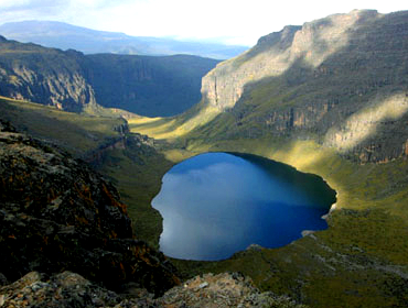
The Chogoria route approaches from the East and there is a National Forest Reserve gate near the village of Chogoria and a National Park gate further up. The route is often described as the most attractive route on Mount Kenya. However, there is no hut for its high camps and it is quite a bit longer unless you use 4×4’s to cut out the lower part. It is normal to drive 4×4’s through the forest until close to or as far as the Meru Bandas (3000m). The next stage is following a 4×4 track a bit further up to the “Roadhead” where you can either branch left for a more direct route, or right to pass Mugi Hill and Lake Ellis. Both tracks re-converge near the head of a spectacular amphitheatre of cliffs know as The Temple, in the bottom of which is Lake Michaelson and at the West end, a large notch where the Nithi River enters. Just above the junction (4300m), is an old rickety hut that porters often sleep in, but clients have to camp. From here the path continues to rise, up to Simba Tarn, here it splits to head either North or South for Shipton’s or Austrian huts respectively.
The physical landscape on this route is its biggest attraction. Whereas the other routes above generally follow a U-Shaped glacial valley for much of the way, the Chogoria traverses around the head of the spectacular ‘Temple’ with the Hall Tarns perched on the rock ledge above it and Lake Michaelson in the base of the amphitheatre. The additional features of Lake Ellis, the Giant’s Billiard Table and the Nithi Falls further add to its interest. The Chogoria is very often used as a descent route after ascending one of the other routes.
BURGURET ROUTE
The Burguret route approaches from the West, not far from the Naro Moru route. It is not well used and does not have a distinct path which can be followed in the way that the others above can, neither does it have any huts or facilities. There is also no KWS Park Gate so prior arrangement has to be made with the rangers and payments made and receipts collected at another gate beforehand. The lower section through the bamboo forest is likely to need ‘route-finding’ by the guides unless another group happens to have been through recently. This means that the actual precise route taken will vary from time to time until out into the moorlands and the first normal camping place at Giant Bamboo Camp (2600m). The next stage is easier in terms of route finding as the ground is more open, however, it is again a matter of making a route rather than following one up to the next usual camp at the rocky outcrops of Highland Castle, 3700m. From here the route continues up thinning flora along the ridge to Hausberg Col (4600m) where it meets the summit circuit and we drop down to Shiptons Camp. From here ascent to Point Lenana can be made using the Sirimon route.
The Burguret route is not well used due to its added difficulties of route finding and lack of facilities. However, this lack of development and the chances that you will be the only party on the route add to the attraction for some people. In addition, it is along a route very similar to this that Felice Benuzzi, Giovanni Balletto and Vincenzo Barsotti made their remarkable climb of the mountain when they escaped from the British PoW Camp in Nanyuki in 1943. The story is recorded in Benuzzi’s fantastic account- ‘No Picnic on Mount Kenya’.
TIMAU ROUTE
The Timau Route approaches from the North from near the village of Timau. It used to be a popular route for ascending in a 4×4 as it follows a meandering route through the gentler northern slopes until they steepen at around 4200m. From here it drops abruptly into and across the Hinde Valley and the Nithi North river before climbing up to meet the Chogoria Route at Hall Tarns. Conditions vary on the route but vehicles generally do not ascend above about 3400m. It is still theoretically possible to climb via this route, though specific advice would need to be sought from the KWS Rangers regarding current conditions.
KAMWETI ROUTE
The Kamweti Route approaches from the south by first driving up from the village of Kutus to the Forest Castle Lodge in the forest zone. You can begin the trek at the lodge or drive a further 6km up to the Kamweti Forest Station at around 2600m. From here it is as much a case of making a track as following one for around 6km through the bamboo and giant heather before emerging out onto a ridge and along to the head of the Kiringa river where it flows out of a large bowl in the mountainside. The next 10km or so sees the heath thin out as the trail reaches a feature known as The Scoop, at the end of a long ridge leading to the peaks. From here the route options are to follow the ridge along to Austrian Hut via Tilman Peak or to traverse West round to MacKinders Hut via lake Hohnel.
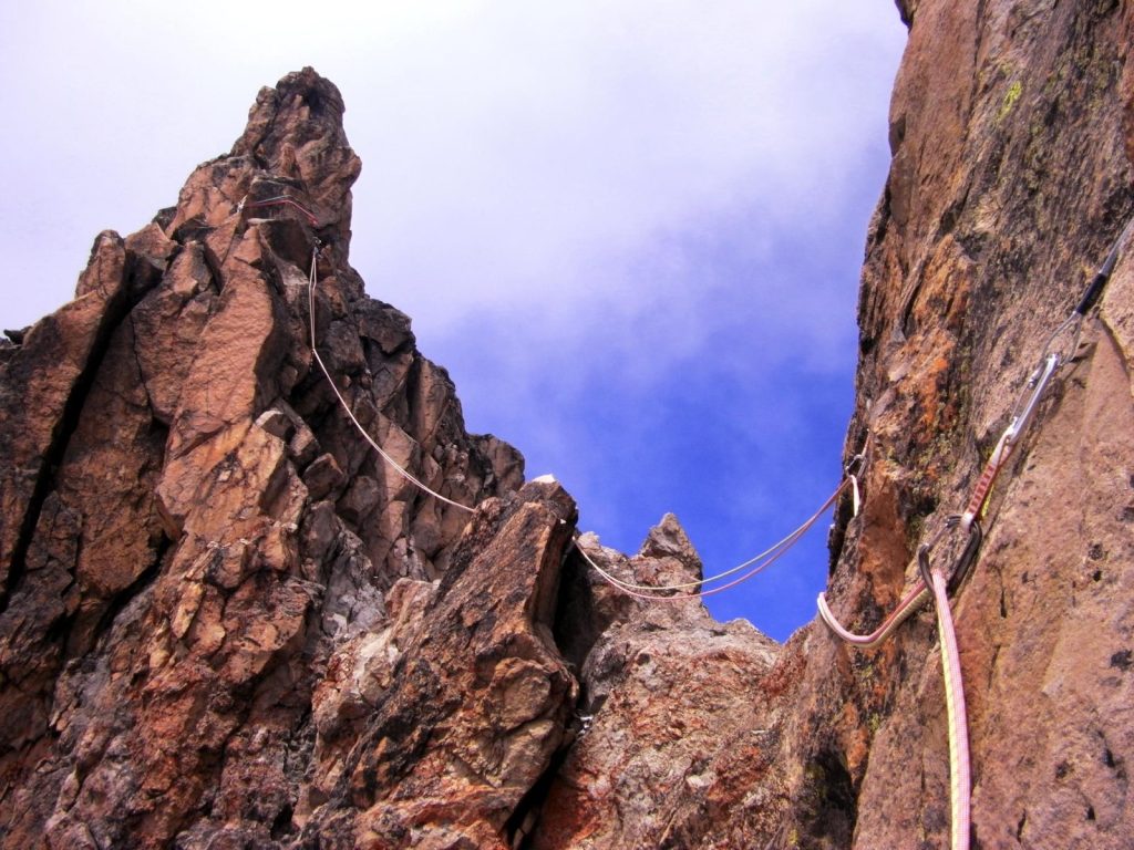
TECHNICAL SUMMITS – BATIAN & NELION
Point Lenana is the third highest point on Mt Kenya after the technical peaks of Nelion and Batian. These peaks are part of the same large body of rock and are separated by a large notch called the gate of the Mists. There are two main ‘standard’ routes to the technical summits. As the peak is essentially on the equator, the sun is on the North faces during UK summer and South faces during the UK winter, though note that on the equator there isn’t really a summer and winter, only really dry and wet seasons. You, therefore, climb the routes that are in the sun so that they are more free from ice and your hands and feet don’t go numb from being in the shade hanging off ice cold rock! Therefore broadly speaking, you would go via the North face to Batian in the UK summer and via the south side during UK winter. The standard south route is the South East face of Nelion, this requires crossing Nelion (and the gate of the mists) to get to Batian.
OTHER PEAKS
Some of the lower grade climbs are as follows (grades are given indicatively only)
- Midget Peak SW Gulley; UIAA III+
- Point John SE Gulley; UIAA III
- Point Peter NE Gulley/Ridge; UIAA III
- Point Dutton NW Face; UIAA II
- Delamere Peak N Face; UIAA II
- Point Pigott NW Face; UIAA III
- Sendeyo S Face; UIAA III
- Tereri NW Ridge; UIAA II
- Krapf Rognon SE; Grade 3 Scramble
- Point Melhuish; ~Grade 3 Scramble
- Shipton’s Peak; ~Grade 2/3 Scramble
- Tilman Peak; ~Grade 2/3 Scramble
- Grigg Peak; ~Grade 2/3 Scramble
- Sommerfelt Peak; ~Grade 2/3 Scramble
- Castle Hill; ~Grade 2/3 Scramble
Climb Mount Kenya with Adventure Alternative for a professional personal service and a great team of guides and staff.
Book Your Adventure of a Lifetime Now
Discover our trips to other Countries
Adventure Alternative Articles
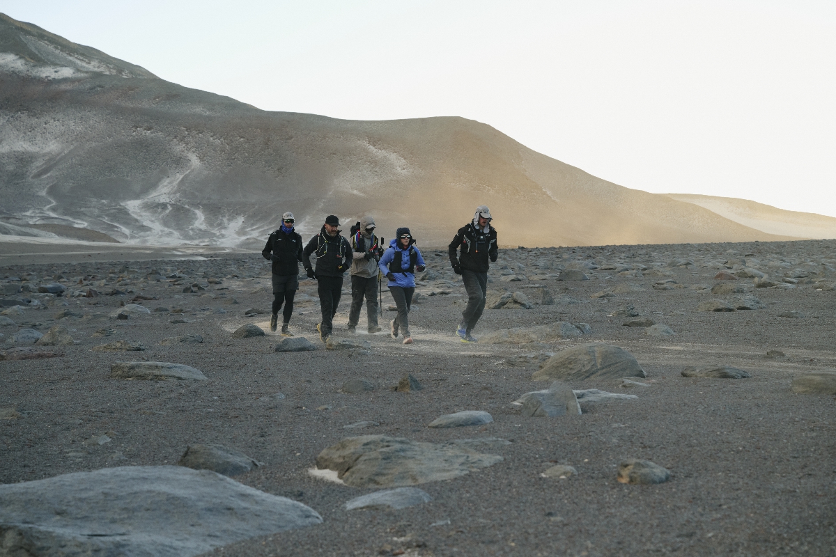
World’s Highest Marathon, Ojos del Salado, Chile
February 2026...after months of planning and organising with BecomingX and our partners High Mountain in Chile, we set off to Copiapo and the...
World Mountain Day
Climbing Calendar Ready for World Mountain Day In celebration of World Mountain Day, we've created a calendar for the year to make it easy for...
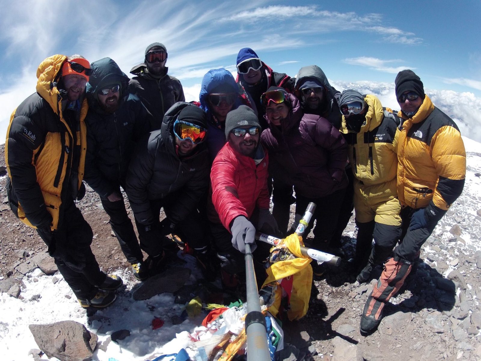
Mount Aconcagua Trip Review
January 2016 This year we had a team of twelve clients from four different countries – Iran, Ireland, England, South Africa and Argentina –...